Difference between revisions of "Huonville, Australia"
From Geohashing
imported>JesseWBot m (Robot: Automated text replacement (-[[Category:Active +[[Category:Inactive)) |
m (per Renaming Proposal) |
||
| (One intermediate revision by one other user not shown) | |||
| Line 18: | Line 18: | ||
== Expeditions == | == Expeditions == | ||
[[2010-07-02 -43 147| Huonville, Australia 2010-07-02]] Success, between Howden and Tinderbox | [[2010-07-02 -43 147| Huonville, Australia 2010-07-02]] Success, between Howden and Tinderbox | ||
| + | |||
| + | == Achievements == | ||
| + | {{Graticule unlocked | latitude = -43 | longitude = 147 | date = 2010-07-02 | name = Alh}} | ||
[[Category:Inactive graticules]] | [[Category:Inactive graticules]] | ||
[[Category:Tasmania]] | [[Category:Tasmania]] | ||
Latest revision as of 07:21, 20 March 2024
| Strathgordon | Hobart | Coles Bay |
| Cairns Bay | Huonville | Cape Pillar |
| -44,146 | -44,147 | -44,148 |
|
Today's location: geohashing.info google osm bing/os kml crox | ||
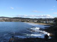
The Huonville graticule is mostly water, consisting primarily of Tasman Sea, Storm Bay, Frederick Henry Bay, and D'entrecasteau Channel. Some of the larger population centres are Huonville, Cygnet, Margate, Dover, and Snug. This graticule is most notable for the inclusion of Bruny Island, and Tasman Peninsula where Port Arthur is located.
Expeditions
Huonville, Australia 2010-07-02 Success, between Howden and Tinderbox
Achievements
Alh earned the Graticule Unlocked Achievement
|
