Difference between revisions of "2009-11-03 41 -72"
imported>Sara (I really want to do a few more Bike Geohashes before the snow comes.) |
imported>FippeBot m (Location) |
||
| Line 50: | Line 50: | ||
[[Category:Coordinates not reached]] | [[Category:Coordinates not reached]] | ||
[[Category:Not reached - No public access]] | [[Category:Not reached - No public access]] | ||
| + | {{location|US|CT|HA}} | ||
Latest revision as of 06:39, 8 August 2019

| Tue 3 Nov 2009 in 41,-72: 41.8987364, -72.5334799 geohashing.info google osm bing/os kml crox |
Location
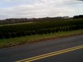
In the trees at the edge of a field in East Windsor, Connecticut.
Participants
Expedition
This was a really fun 40.5km bike ride, my longest bike ride ever. It took me just under four hours. I didn't make it to the hashpoint due to a No Trespassing sign, but I saw a lot of interesting stuff.
Photos
On the Way There
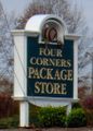
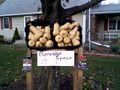
This was about an hour into the trip. I had thought the term "package store" was used everywhere, but recently found out that it's local to some parts of New England and, apparently, Georgia. (It doesn't mean a store for packaging.)
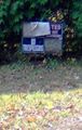
It was election day, but not for me, because the elections around here were all local elections, and my town didn't have one. I'm no Republican, but their election-day attention getter is certainly effective.

I wonder how many school districts in the USA have a John F. Kennedy school.
My trusty bike, Marguerite, a few km from the hashpoint, with one of several decorated fire hydrants that I saw in East Windsor.
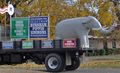
A very pretty sight 1 or 2 km from the hashpoint. So this is where the shrubs on people's lawns come from.
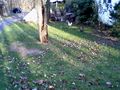
I was stopped about 270 m from the hashpoint, at the end of the landowner's very long driveway.


On the Way Home
Just to keep it inetersting, I did this tron-style, going home by a different route. (Even if I had made it, this would not have officially been a tron achievement - I'm too lazy to avoid crossing my path when I get off the bike to take pictures.)
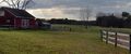
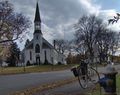
Just a km or two after leaving the hashpoint, I came to this barn and these horses.
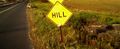
I don't fully understand the purpose of this sign.
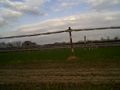
To get shade-grown tobacco, they lower the cheesecloth drapes at some point during the growing season.
These chickens were loose in someone's yard, right near the street.
I rode past this place, then turned around and bought something for the next day's dinner.
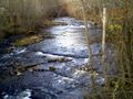
Scantic Rapids. The kids and I tried and failed to find a geocache here once.


