Difference between revisions of "2010-05-23 54 13"
imported>Reinhard (creating) |
imported>FippeBot m (Location) |
||
| (7 intermediate revisions by one other user not shown) | |||
| Line 1: | Line 1: | ||
| − | |||
| − | |||
| − | |||
| − | |||
| − | |||
| − | |||
| − | |||
{{meetup graticule | {{meetup graticule | ||
| lat=54 | | lat=54 | ||
| − | | lon= | + | | lon=13 |
| date=2010-05-23 | | date=2010-05-23 | ||
}} | }} | ||
| − | |||
| − | |||
__NOTOC__ | __NOTOC__ | ||
== Location == | == Location == | ||
| − | + | In a rapeseed field south of Garz on Germany's largest island Rügen. | |
== Participants == | == Participants == | ||
| − | + | * [[user:Manu|Manu]] | |
| − | + | * [[user:Reinhard|Reinhard]] | |
| − | |||
| − | |||
== Expedition == | == Expedition == | ||
| − | + | Manu and Reinhard were spending this year's Whitsun weekend on Rügen. They were happy, when they saw that the Sunday hash of the 54 13 graticule would be located on the island. As the satellite picture showed the hashpoint being in the middle of a large field, they weren't too enthusiastic about the success of their expedition. | |
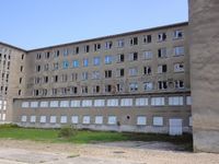
| − | + | After cycling through the northern part of the island the day before, the weather got wonderful on Sunday and Manu and Reinhard could start their second bike trip from their vacation home in Zubzow. They cycled through Bergen and Lietzow and visited the unfinished seaside resort of Prora, which was built between 1935 and 1939 by the nazi regime. After having ice cream at the beach, they rode on to Binz and climbed the hill to the hunting palace Granitz, which is known for its terrifying stairway, that Reinhard of course couldn't miss to walk up and down. They had lunch there and rode on to Sellin and its famous pier. Next short stop was Putbus and after that they headed straight towards Garz and further south, where they at some point passed the hashpoint. The field turned out to be covered with rapeseed plants (as most of Rügen's farmland) and looked quite impenetrable. It would have been 400 m from the road and still about 150 m from an expected field path behind the hashpoint, so Manu and Reinhard gave up on getting there and just showed Procter and Wischi, where the hashpoint was about to be. The last 30 km home were a bit exhausting due to heavy headwind, but they agreed upon the cobblestone pavements, which you can find in many villages and towns on Rügen, being the worst enemy of road bikers on that island. After 127 km (+10 extra km for Reinhard) they finished their round trip and enjoyed the pasta and elevating their feet. | |
| − | |||
== Photos == | == Photos == | ||
| − | + | {{gallery|width=200|height=200|lines=3 | |
| − | Image: | + | |Image:20100523-54N13E-01.jpg|Colossus of Prora. |
| − | -- | + | |Image:20100523-54N13E-02.jpg|Maybe ... (have a closer look) |
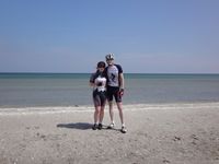
| − | + | |Image:20100523-54N13E-03.jpg|At the beach. | |
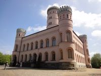
| − | + | |Image:20100523-54N13E-04.jpg|Hunting palace/lodge Granitz. | |
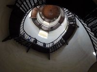
| + | |Image:20100523-54N13E-05.jpg|Inside. | ||
| + | |Image:20100523-54N13E-06.jpg|Pier of Sellin. | ||
| + | |Image:20100523-54N13E-07.jpg|Near the hash, view towards Garz. You can see the Telekom radio/TV mast on the left. | ||
| + | |Image:20100523-54N13E-08.jpg|View towards the hash (behind the wood). | ||
| + | |Image:20100523-54N13E-09.jpg|400 m ... too far into the rapeseed. | ||
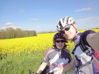
| + | |Image:20100523-54N13E-10.jpg|Unsuccessful hashers. | ||
| + | |Image:20100523-54N13E-11.jpg|Unsuccessful, but happy hashers Procter and Wischi. | ||
| + | }} | ||
== Achievements == | == Achievements == | ||
| − | |||
| − | |||
| − | |||
| − | |||
| − | |||
| − | |||
| − | |||
| − | |||
| − | |||
| − | |||
| − | |||
| − | |||
| − | |||
| − | |||
[[Category:Expeditions]] | [[Category:Expeditions]] | ||
| − | |||
[[Category:Expeditions with photos]] | [[Category:Expeditions with photos]] | ||
| − | |||
| − | |||
| − | |||
| − | |||
| − | |||
| − | |||
| − | |||
| − | |||
| − | |||
[[Category:Coordinates not reached]] | [[Category:Coordinates not reached]] | ||
| − | |||
| − | |||
[[Category:Not reached - No public access]] | [[Category:Not reached - No public access]] | ||
| − | + | {{location|DE|MV|VR}} | |
| − | |||
| − | |||
Latest revision as of 02:09, 9 August 2019
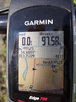
| Sun 23 May 2010 in 54,13: 54.3009670, 13.3572874 geohashing.info google osm bing/os kml crox |
Location
In a rapeseed field south of Garz on Germany's largest island Rügen.
Participants
Expedition
Manu and Reinhard were spending this year's Whitsun weekend on Rügen. They were happy, when they saw that the Sunday hash of the 54 13 graticule would be located on the island. As the satellite picture showed the hashpoint being in the middle of a large field, they weren't too enthusiastic about the success of their expedition.
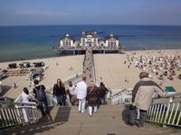
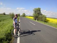
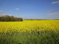
After cycling through the northern part of the island the day before, the weather got wonderful on Sunday and Manu and Reinhard could start their second bike trip from their vacation home in Zubzow. They cycled through Bergen and Lietzow and visited the unfinished seaside resort of Prora, which was built between 1935 and 1939 by the nazi regime. After having ice cream at the beach, they rode on to Binz and climbed the hill to the hunting palace Granitz, which is known for its terrifying stairway, that Reinhard of course couldn't miss to walk up and down. They had lunch there and rode on to Sellin and its famous pier. Next short stop was Putbus and after that they headed straight towards Garz and further south, where they at some point passed the hashpoint. The field turned out to be covered with rapeseed plants (as most of Rügen's farmland) and looked quite impenetrable. It would have been 400 m from the road and still about 150 m from an expected field path behind the hashpoint, so Manu and Reinhard gave up on getting there and just showed Procter and Wischi, where the hashpoint was about to be. The last 30 km home were a bit exhausting due to heavy headwind, but they agreed upon the cobblestone pavements, which you can find in many villages and towns on Rügen, being the worst enemy of road bikers on that island. After 127 km (+10 extra km for Reinhard) they finished their round trip and enjoyed the pasta and elevating their feet.
Photos
|

