Difference between revisions of "User:Bierhefe"
From Geohashing
imported>Bierhefe (→Successful expeditions (total: 1)) |
imported>Bierhefe (→Unsuccessful expeditions (total: 4, newest on top)) |
||
| (35 intermediate revisions by the same user not shown) | |||
| Line 1: | Line 1: | ||
| − | {{ASG|Y=1981|m=08|d=13|gender=m|lat=53|lon= | + | {{ASG|Y=1981|m=08|d=13|gender=m|lat=53|lon=9}} |
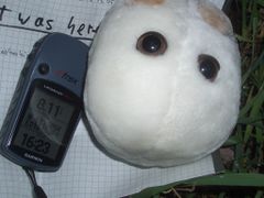
| − | + | [[Image:HamburgHashCotGPSAndMarker01.JPG|right|240px]] | |
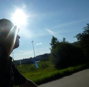
| − | + | [[Image:2011-08-02-011.jpg|Me cycling|thumb|right]] | |
| − | ==Successful expeditions (total: | + | =About= |
| − | *'''[[2011-02-11 53 10]]''' | + | I don't exactly know how I learned about geohashing. I'm an avid reader of the XKCD webcomics, so I probably learned about geohashing there. Anyway, I try to use geohashing as an excuse to get out more. I do own a driver's licence by now, but I don't own a car. So I still have to wait for hashes that are reachable by bike or by foot. Also, I moved from Hamburg to Buchholz, so now I'm a resident of the Hamburg, West graticule.<br> |
| − | *'''[[2010-11-24 53 10]]''' | + | Also I try to drag along my wife to the hashes (she likes the idea of geohashing as well), but since her work schedule keeps her occupied I have to go alone most of the time. :( |
| + | |||
| + | *'''Distance I cycled just because of geohashing''': 103,2 km. | ||
| + | *:- Longest expedition: [[2011-08-02 53 10]]: 59,4 km. | ||
| + | *:- 100 km cycled in total on 2011-08-02. | ||
| + | |||
| + | =Expeditions (total: 8)= | ||
| + | |||
| + | ==Successful expeditions (total: 5, newest on top)== | ||
| + | *'''[[2011-12-30 53 10]]''' - In a forest between Hamburg and Glinde, with my wife. | ||
| + | *'''[[2011-08-02 53 10]]''' - On a field near Elmenhorst, alone. | ||
| + | *'''[[2011-05-10 53 10]]''' - In the Saxony Forest, with my wife. | ||
| + | *'''[[2011-02-11 53 10]]''' - Near the train station Nettelnburg on a street, alone. | ||
| + | *'''[[2010-11-24 53 10]]''' - On a muddy trail in Oststeinbek, alone. | ||
| + | |||
| + | ==Unsuccessful expeditions (total: 5, newest on top)== | ||
| + | *'''[[2018-09-21 53 9]]''' - On a field near Asendorf. Didn't attempt due to stormy weathr conditions. | ||
| + | *'''[[2013-04-07 53 10]]''' - On the river Bille (a tributary of the Elbe) near Billstedt. Coordinates not reached. No boat available! | ||
| + | *'''[[2012-07-11 53 10]]''' - In a forest between Aumühle and Dassendorf. Aborted due to heavy rainfall. | ||
| + | *'''[[2011-06-01 53 10]]''' - On a field near Curslack. Coordinates not reached, no trespassing! | ||
| + | *'''[[2011-03-03 53 10]]''' - On a muddy field between Boberg and Lohbrügge. Coordinates not reached due to a fence that blocked the path. | ||
| + | |||
| + | ==Retro expeditions (1)== | ||
| + | *'''[[2011-07-26 53 10]]''' - On a field near Brunstorf, got to this hash point on my way to the [[2011-08-02 53 10|2011-08-02]] hash point for [[53,10]]. | ||
| + | |||
| + | =Achievements= | ||
| + | My achievements. I am so proud. :) | ||
== Single Achievements (first times only)== | == Single Achievements (first times only)== | ||
| + | {{#vardefine:ribbonwidth|1000px}} | ||
{{land geohash | {{land geohash | ||
| latitude = 53 | | latitude = 53 | ||
| Line 22: | Line 49: | ||
| distance = 8.1 km | | distance = 8.1 km | ||
}} | }} | ||
| − | |||
{{Public transport geohash | {{Public transport geohash | ||
| latitude = 53 | | latitude = 53 | ||
| Line 30: | Line 56: | ||
| name = [[User:Bierhefe|Bierhefe]] | | name = [[User:Bierhefe|Bierhefe]] | ||
}} | }} | ||
| − | + | {{Walk geohash | |
| + | | latitude = 53 | ||
| + | | longitude = 10 | ||
| + | | date = 2011-12-30 | ||
| + | | name = [[User:Bierhefe|Bierhefe]] and his wife | ||
| + | | distance = 4.98 km | ||
| + | }} | ||
| + | |||
| + | == Single Geohash Challenges == | ||
| + | {{Velociraptor geohash | ||
| + | | latitude = 53 | ||
| + | | longitude = 10 | ||
| + | | date = 2011-03-03 | ||
| + | | name = [[User:Bierhefe|Bierhefe]] | ||
| + | | image = 2011-03-03-08.JPG | ||
| + | }} | ||
| + | {{Velociraptor geohash | ||
| + | | latitude = 53 | ||
| + | | longitude = 10 | ||
| + | | date = 2011-08-02 | ||
| + | | name = [[User:Bierhefe|Bierhefe]] | ||
| + | | image = 2011-08-02-019.jpg | ||
| + | }} | ||
| + | |||
| + | == Consolation Prizes == | ||
| + | {{#vardefine:ribbonwidth|1000px}} | ||
| + | {{gratuitous ribbon | ||
| + | | color = red | ||
| + | | icon = Facepalm.png | ||
| + | | latitude = 53 | ||
| + | | longitude = 10 | ||
| + | | date = 2011-03-03 | ||
| + | | achievement = I walked all this way and all I got was this lousy consolation ribbon? | ||
| + | | description = fighting his way over a muddy field for over 1km just to find out there was a fence blocking his path 150m away from the actual hash point. | ||
| + | | name = [[User:Bierhefe|Bierhefe]] | ||
| + | }} | ||
| + | {{Radio Yerevan | ||
| + | | achievement = [[Picnic achievement]] | ||
| + | | detail = he didn't bring any of the required accoutrements | ||
| + | | latitude = 53 | ||
| + | | longitude = 10 | ||
| + | | date = 2011-05-10 | ||
| + | | name = [[User:Bierhefe|Bierhefe]] and his wife | ||
| + | | food = Cucumber and pepper | ||
| + | }} | ||
| + | {{No trespassing | ||
| + | | latitude = 53 | ||
| + | | longitude = 10 | ||
| + | | date = 2011-06-01 | ||
| + | | name = [[User:Bierhefe|Bierhefe]] | ||
| + | | image = 2011-06-01-003.JPG | ||
| + | }} | ||
| + | {{gratuitous ribbon | ||
| + | | color = black | ||
| + | | icon = Toughguy.gif | ||
| + | | latitude = 53 | ||
| + | | longitude = 10 | ||
| + | | date = 2011-08-02 | ||
| + | | achievement = Tough Guy Gratious Ribbon | ||
| + | | description = finishing this expedition despite being attacked by raptors, wasps, gnats and other insects that Mother Nature has to offer. | ||
| + | | name = [[User:Bierhefe|Bierhefe]] | ||
| + | }} | ||
| + | {{gratuitous ribbon | ||
| + | |color=red | ||
| + | |latitude=53 | ||
| + | |longitude=10 | ||
| + | |date=2011-08-02 | ||
| + | |name=[[User:Bierhefe|Bierhefe]] | ||
| + | |achievement=Multihash achievement (variant) | ||
| + | |description=reaching a retro geohash on the same expedition as reaching the | ||
| + | |icon=Minesweeper geohash 2.png | ||
| + | }} | ||
| + | {{My kingdom for a boat | ||
| + | | latitude = 53 | ||
| + | | longitude = 10 | ||
| + | | date = 2013-04-07 | ||
| + | | name = [[User:Bierhefe|Bierhefe]] | ||
| + | }} | ||
Latest revision as of 08:42, 24 September 2018
Contents
About
I don't exactly know how I learned about geohashing. I'm an avid reader of the XKCD webcomics, so I probably learned about geohashing there. Anyway, I try to use geohashing as an excuse to get out more. I do own a driver's licence by now, but I don't own a car. So I still have to wait for hashes that are reachable by bike or by foot. Also, I moved from Hamburg to Buchholz, so now I'm a resident of the Hamburg, West graticule.
Also I try to drag along my wife to the hashes (she likes the idea of geohashing as well), but since her work schedule keeps her occupied I have to go alone most of the time. :(
- Distance I cycled just because of geohashing: 103,2 km.
- - Longest expedition: 2011-08-02 53 10: 59,4 km.
- - 100 km cycled in total on 2011-08-02.
Expeditions (total: 8)
Successful expeditions (total: 5, newest on top)
- 2011-12-30 53 10 - In a forest between Hamburg and Glinde, with my wife.
- 2011-08-02 53 10 - On a field near Elmenhorst, alone.
- 2011-05-10 53 10 - In the Saxony Forest, with my wife.
- 2011-02-11 53 10 - Near the train station Nettelnburg on a street, alone.
- 2010-11-24 53 10 - On a muddy trail in Oststeinbek, alone.
Unsuccessful expeditions (total: 5, newest on top)
- 2018-09-21 53 9 - On a field near Asendorf. Didn't attempt due to stormy weathr conditions.
- 2013-04-07 53 10 - On the river Bille (a tributary of the Elbe) near Billstedt. Coordinates not reached. No boat available!
- 2012-07-11 53 10 - In a forest between Aumühle and Dassendorf. Aborted due to heavy rainfall.
- 2011-06-01 53 10 - On a field near Curslack. Coordinates not reached, no trespassing!
- 2011-03-03 53 10 - On a muddy field between Boberg and Lohbrügge. Coordinates not reached due to a fence that blocked the path.
Retro expeditions (1)
- 2011-07-26 53 10 - On a field near Brunstorf, got to this hash point on my way to the 2011-08-02 hash point for 53,10.
Achievements
My achievements. I am so proud. :)
Single Achievements (first times only)
Bierhefe earned the Land geohash achievement
|
Error creating thumbnail: Unable to save thumbnail to destination |
Bierhefe earned the Bicycle geohash achievement
|
Bierhefe earned the Public transport geohash achievement
|
Bierhefe and his wife earned the Walk geohash Achievement
|
Single Geohash Challenges
Bierhefe earned the Velociraptor Geohash Achievement
|
Bierhefe earned the Velociraptor Geohash Achievement
|
Consolation Prizes
Bierhefe earned the I walked all this way and all I got was this lousy consolation ribbon?
|
Is it true that this user earned the Picnic achievement?
|
Bierhefe earned the No trespassing consolation prize
|
Bierhefe earned the Tough Guy Gratious Ribbon
|
Bierhefe earned the Multihash achievement (variant)
|
Bierhefe earned the My kingdom for a boat consolation prize
|
Categories:
- Geohashers
- Geohashers in their 40s
- Geohashers in 53,9
- Land geohash achievement
- Bicycle geohash achievement
- Public transport geohash achievement
- Walk geohash achievement
- Velociraptor geohash achievement
- Gratuitous ribbon achievement
- Radio Yerevan
- No trespassing consolation prize
- My kingdom for a boat consolation prize

