Difference between revisions of "2011-07-31 47 7"
From Geohashing
imported>TheOneRing (Created page with "{{meetup graticule | lat=47 | lon=7 | date=2011-07-31 }} == Location == The geohash is located on a field near Jegenstorf, approx. 15km North of Berne. == Participants == [[Use...") |
imported>FippeBot m (Location) |
||
| (3 intermediate revisions by one other user not shown) | |||
| Line 15: | Line 15: | ||
What the heck...? Seriously, what the heck? The second failure in the row. | What the heck...? Seriously, what the heck? The second failure in the row. | ||
| − | In fact, it was the first day with good weather for weeks, and I decided to go by bike. A little bit up and down, but mostly the roads were flat. After 15km I reached Jegenstorf, drove through and saw crop fields. Unfortunately they were not | + | In fact, it was the first day with good weather for weeks, and I decided to go by bike. A little bit up and down, but mostly the roads were flat. After 15km I reached Jegenstorf, drove through and saw crop fields. Unfortunately they were not harvested yet. In the middle of one field there was the geohash...unreachable. I did not came closer than 100m without marching into the field and destroying the grain, and why should I do this? So, I left and felt low. |
Well, better try next time. | Well, better try next time. | ||
| Line 21: | Line 21: | ||
== Photos == | == Photos == | ||
=== TheOneRing === | === TheOneRing === | ||
| − | I | + | <gallery perrow="3"> |
| + | Image:20110731Me.jpg|I cannot believe what I see,... | ||
| + | Image:20110731Geohash.jpg|...the geohash is in the middle of that field,... | ||
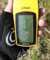
| + | Image:20110731GPS.jpg|...but way too far away to reach. | ||
| + | </gallery> | ||
| + | |||
== Consolidation prizes == | == Consolidation prizes == | ||
| Line 27: | Line 32: | ||
[[Category:Expeditions]] | [[Category:Expeditions]] | ||
| + | [[Category:Expeditions with photos]] | ||
[[Category:Coordinates not reached]] | [[Category:Coordinates not reached]] | ||
| + | [[Category:Not reached - No public access]] | ||
| + | {{location|CH|BE}} | ||
Latest revision as of 00:17, 13 August 2019
| Sun 31 Jul 2011 in 47,7: 47.0563467, 7.5150552 geohashing.info google osm bing/os kml crox |
Contents
Location
The geohash is located on a field near Jegenstorf, approx. 15km North of Berne.
Participants
TheOneRing - by bike.
The Expedition
TheOneRing
What the heck...? Seriously, what the heck? The second failure in the row.
In fact, it was the first day with good weather for weeks, and I decided to go by bike. A little bit up and down, but mostly the roads were flat. After 15km I reached Jegenstorf, drove through and saw crop fields. Unfortunately they were not harvested yet. In the middle of one field there was the geohash...unreachable. I did not came closer than 100m without marching into the field and destroying the grain, and why should I do this? So, I left and felt low.
Well, better try next time.
Photos
TheOneRing
Consolidation prizes
TheOneRing earned the No trespassing consolation prize
|


