Difference between revisions of "2014-05-31 50 11"
imported>Jens (Created page with "{{meetup graticule | lat=50 | lon=11 | date=2014-05-31 }} __NOTOC__ == Location == In a meadow near Hetschburg. == Participants == * Jens and Räbe (not even ...") |
imported>FippeBot m (Location) |
||
| (3 intermediate revisions by one other user not shown) | |||
| Line 15: | Line 15: | ||
To late I noticed that yesterday there was a point around Jena, so I missed that one. But today I had another chance. And I missed again. Thereby I found a new law of nature and it’s very simple: Hashpoints between May 31 and June 10 do not work. Now it’s the third year in a row I was exploring this theory and the result is always the same. And although a sample with 3 elements should be enough as proof, I will continue researching next year. | To late I noticed that yesterday there was a point around Jena, so I missed that one. But today I had another chance. And I missed again. Thereby I found a new law of nature and it’s very simple: Hashpoints between May 31 and June 10 do not work. Now it’s the third year in a row I was exploring this theory and the result is always the same. And although a sample with 3 elements should be enough as proof, I will continue researching next year. | ||
| − | But back to the present. I started early in the morning and drove the same way as on April 12, but didn’t leave the Ilm cycle way in Buchfahrt. Instead I continued until I reached Hetschburg. From here it were only some hundred meters on a path into the forest where the point was located. In google earth it looked like a nice meadow, that should be no problem. But the meadow was surrounded by a fence and seamed to be the home area of some horses. When I first saw this quandary, I thought whether I should overcome the fence, since it looked like the horses were actually | + | But back to the present. I started early in the morning and drove the same way as on [[2014-04-12_50_11|April 12]], but didn’t leave the Ilm cycle way in Buchfahrt. Instead I continued until I reached Hetschburg. From here it were only some hundred meters on a path into the forest where the point was located. In google earth it looked like a nice meadow, that should be no problem. But the meadow was surrounded by a fence and seamed to be the home area of some horses. When I first saw this quandary, I thought whether I should overcome the fence, since it looked like the horses were actually in a part of the area that was separated from the target area by a small dried out river. Just when I wanted to explore the location the horses got very nervous and started neighing. That was the time were I decided to put this point to the not-reached list. |
To complete the loss list, I decided to continue to Bad Berka, where I wanted to try a | To complete the loss list, I decided to continue to Bad Berka, where I wanted to try a | ||
[http://www.wherigo.com/cartridge/details.aspx?CGUID=6ece6c69-27ec-4fa5-a517-35e602758600 Wherigo] on a new toy I got some days ago. But I already started with a bad feeling, since I didn’t like the description at all. And my fears became true. The first task was to run over a 1,5 meters wide bridge, that was full of grandmas at this time. Not with me. I immediately canceled this action too and declared this day to be a looser day. But however, the weather was fine, the landscape too, so at the end it was not that bad at all. | [http://www.wherigo.com/cartridge/details.aspx?CGUID=6ece6c69-27ec-4fa5-a517-35e602758600 Wherigo] on a new toy I got some days ago. But I already started with a bad feeling, since I didn’t like the description at all. And my fears became true. The first task was to run over a 1,5 meters wide bridge, that was full of grandmas at this time. Not with me. I immediately canceled this action too and declared this day to be a looser day. But however, the weather was fine, the landscape too, so at the end it was not that bad at all. | ||
| + | == Photos == | ||
| − | + | {{gallery|width=200|height=200|lines=2 | |
| + | |Image:140531 50 11 01.JPG|The audience, not very interested | ||
| + | |Image:140531 50 11 02.JPG|Remains of last Thursday. So be careful where you go. | ||
| + | |Image:140531 50 11 03.JPG|View back the Ilm cycle way | ||
| + | |Image:140531 50 11 04.JPG|The fence and a lot of stinging nettles. Anybody who want's to enter? | ||
| + | |Image:140531 50 11 05.JPG|the dried out river I used as path. | ||
| + | |Image:140531 50 11 06.JPG|What the hell is that man doing there? ... | ||
| + | |Image:140531 50 11 07.JPG|... I do not like that. He has to leave or I will call my faaaaaarmer .... | ||
| + | }} | ||
| − | |||
[[Category:Expeditions with photos]] | [[Category:Expeditions with photos]] | ||
| Line 29: | Line 37: | ||
[[Category:Coordinates not reached]] | [[Category:Coordinates not reached]] | ||
[[Category:Not reached - No public access]] | [[Category:Not reached - No public access]] | ||
| + | {{location|DE|TH|AP}} | ||
Latest revision as of 06:45, 14 August 2019
| Sat 31 May 2014 in 50,11: 50.9179713, 11.3020586 geohashing.info google osm bing/os kml crox |
Location
In a meadow near Hetschburg.
Participants
- Jens and Räbe (not even leaving the bag)
Expedition
To late I noticed that yesterday there was a point around Jena, so I missed that one. But today I had another chance. And I missed again. Thereby I found a new law of nature and it’s very simple: Hashpoints between May 31 and June 10 do not work. Now it’s the third year in a row I was exploring this theory and the result is always the same. And although a sample with 3 elements should be enough as proof, I will continue researching next year.
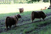
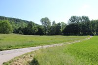
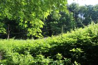
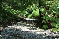
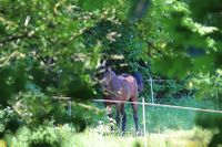
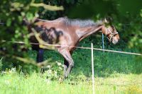
But back to the present. I started early in the morning and drove the same way as on April 12, but didn’t leave the Ilm cycle way in Buchfahrt. Instead I continued until I reached Hetschburg. From here it were only some hundred meters on a path into the forest where the point was located. In google earth it looked like a nice meadow, that should be no problem. But the meadow was surrounded by a fence and seamed to be the home area of some horses. When I first saw this quandary, I thought whether I should overcome the fence, since it looked like the horses were actually in a part of the area that was separated from the target area by a small dried out river. Just when I wanted to explore the location the horses got very nervous and started neighing. That was the time were I decided to put this point to the not-reached list.
To complete the loss list, I decided to continue to Bad Berka, where I wanted to try a Wherigo on a new toy I got some days ago. But I already started with a bad feeling, since I didn’t like the description at all. And my fears became true. The first task was to run over a 1,5 meters wide bridge, that was full of grandmas at this time. Not with me. I immediately canceled this action too and declared this day to be a looser day. But however, the weather was fine, the landscape too, so at the end it was not that bad at all.
Photos
|
