Difference between revisions of "2008-07-05 53 9"
From Geohashing
imported>Brettdaniel (map template) |
imported>FippeBot m (Location) |
||
| (3 intermediate revisions by 3 users not shown) | |||
| Line 9: | Line 9: | ||
[[Image:Wluut-2008-07-05-2.jpg|thumb|300px|Geohash marker.]] | [[Image:Wluut-2008-07-05-2.jpg|thumb|300px|Geohash marker.]] | ||
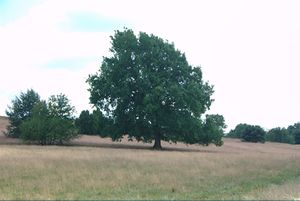
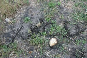
| − | The geohash coordinates were located within the nature reserve "Lüneburger Heide", so leaving the tracks was not allowed. But [[User:Wluut|Wluut]] and Friend managed to get within | + | The geohash coordinates were located within the nature reserve "Lüneburger Heide", so leaving the tracks was not allowed. But [[User:Wluut|Wluut]] and Friend managed to get within 25 meter of the designated location. |
| + | |||
| + | [[Category:Expeditions]] | ||
| + | [[Category:Expeditions with photos]] | ||
| + | [[Category:Coordinates not reached]] | ||
| + | [[Category:Not reached - No public access]] | ||
| + | {{location|DE|NI|HK}} | ||
Latest revision as of 05:44, 7 August 2019
| Sat 5 Jul 2008 in 53,9: 53.1489437, 9.9212957 geohashing.info google osm bing/os kml crox |
The geohash coordinates were located within the nature reserve "Lüneburger Heide", so leaving the tracks was not allowed. But Wluut and Friend managed to get within 25 meter of the designated location.

