Difference between revisions of "2024-07-24 49 8"
Green guy! (talk | contribs) (Create expedition planning page) |
Green guy! (talk | contribs) (Add OpenStreetMap achievement; cleanup) |
||
| (11 intermediate revisions by 2 users not shown) | |||
| Line 1: | Line 1: | ||
| − | |||
| − | |||
| − | |||
{{meetup graticule | {{meetup graticule | ||
| lat=49 | | lat=49 | ||
| Line 7: | Line 4: | ||
| date=2024-07-24 | | date=2024-07-24 | ||
}} | }} | ||
| + | == Fun Fact == | ||
| + | This date is known as the <strong>International Day of Joy</strong>. Geohashing fits this theme very well as it’s a joyful activity. | ||
== Location == | == Location == | ||
| − | + | In a field, about 50 meters away from the closest agricultural road, in Darmstadt-Dieburg county, Hesse, Germany. The closest settlement is Groß-Zimmern in northeast direction. | |
| − | In a field, about 50 meters away from the closest agricultural road, in Darmstadt-Dieburg county, Hesse, Germany. The closest settlement is Groß-Zimmern in northeast direction. | + | |
| − | + | This day’s weather: partially sunny and cloudy, warm (~23 °C) | |
| − | This day’s weather: sunny | ||
== Participants == | == Participants == | ||
* [[User:Green guy!|Green guy!]] ([[User talk:Green guy!|talk]]) | * [[User:Green guy!|Green guy!]] ([[User talk:Green guy!|talk]]) | ||
| − | |||
* Green guy!’s mother | * Green guy!’s mother | ||
* Green guy!’s father | * Green guy!’s father | ||
== Plans == | == Plans == | ||
| − | # Drive to Groß-Zimmern in the | + | # Drive to Groß-Zimmern in the early evening and park our car at the southwest edge of the settlement |
| − | # Go on a walk to visit the hashpoint (estimated hashpoint arrival | + | # Go on a walk to visit the hashpoint (estimated hashpoint arrival between 17:15 and 17:30) |
| − | # | + | # Have a joyful dinner in a nearby restaurant |
# Drive back home | # Drive back home | ||
== Expedition == | == Expedition == | ||
| + | In a nutshell: We didn’t reach the coordinates in respect of the crops growing on the aforementioned field. <small>(This does count as ''No public access'', by the way.)</small> Which type of crop, you may ask? Keep reading! | ||
| + | |||
=== The way there === | === The way there === | ||
| − | + | We started driving towards Groß-Zimmern at 16:45. (Originally, I planned the expedition to start 30 to 60 minutes later, but we had to be done at 19:00 so my father can attend his prayer group.) While still in Darmstadt, we had to avoid some traffic congestion by turning left onto Erbacher Straße to reach the ''<span style="padding-right: 0.2em">B</span>26'' motorroad. | |
| − | |||
| − | + | === Approaching the coordinates === | |
| − | File: | + | Despite noticing many no-parking zones in the southwest residential area of Groß-Zimmern, we found a streetside place to park our car. |
| + | |||
| + | From there, it was a 1.5 kilometer walk to the hashpoint. On our way through a scenic landscape of fields and farms, we saw a lot of interesting and delightful details: | ||
| + | <gallery class="center" widths="390px" heights="200px"> | ||
| + | File:OMIMG_20240724_171317.jpg|alt="residential road transitioning into rural road"| | ||
| + | File:OMIMG_20240724_171412.jpg|alt="paved rural road surrounded by meadows"|We are going on an agricultural adventure! | ||
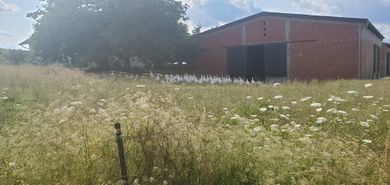
| + | File:OMIMG_20240724_171656.jpg|alt="farm buildings behind a barley field"| | ||
| + | File:OMIMG_20240724_171730.jpg|alt="deep-pink flowers at the edge of a barley field"| | ||
| + | File:OMIMG_20240724_171758.jpg|alt="gaggle of geese in front of farm building"|Untitled Goose <s>Game</s> Geohashing | ||
| + | File:OMIMG_20240724_172239.jpg|alt="potato field"|Mmmh, tasty potatoes are growing here … | ||
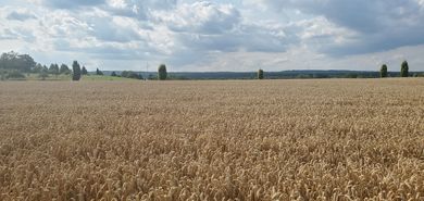
| + | File:OMIMG_20240724_172321.jpg|alt="scenic rural landscape with wheat field in the front"| | ||
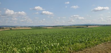
| + | File:OMIMG_20240724_172333.jpg|alt="scenic rural landscape with turnip field in the front"| | ||
| + | File:OMIMG_20240724_172638.jpg|alt="paved agricultural road in scenic rural landscape"|Turn left after the green-colored turnip field! | ||
</gallery> | </gallery> | ||
| − | <gallery class="center" widths=" | + | Staying on agricultural roads, we got within a radius of 50 meters from the coordinates just after 17:30. As we didn’t want to trample any turnips (out of respect for the produce, the farmer and the law), we kept our distance from the hashpoint, with myself taking some interesting photos. |
| − | File: | + | <gallery class="center" widths="150px" heights="200px"> |
| + | File:OMIMG_20240724_173357.jpg|alt="my arm pointing straight on, into turnip field"|Pointing at the coordinates | ||
| + | File:OMIMG_20240724_173431.jpg|alt="turnips closeup"|Better not trample these tender turnips! | ||
| + | File:Screenshot_20240724-173554_OruxMaps.png|alt="OruxMaps screenshot, refer to caption"|Map centered on geohash; my GPS position is on the bottom left, 50 m away from the coordinates. | ||
</gallery> | </gallery> | ||
| − | <gallery class="center" widths=" | + | While walking back to our car, we had some interesting topics to talk about while I was in awe of the whole agricultural system. |
| − | File: | + | <gallery class="center" widths="300px" heights="200px"> |
| + | File:OMIMG_20240724_173804.jpg|alt="plant with foggy-looking things in the place of flowers, in front of wheat field"|Interesting plant with foggy-looking thingies<sup>[botany terms are not easy!]</sup> | ||
| + | File:OMIMG_20240724_173821.jpg|alt="closeup of wheat ears"|Wheat closeup | ||
| + | File:OMIMG_20240724_174120.jpg|alt="some flowers in front of turnip field"| | ||
| + | File:OMIMG_20240724_174140.jpg|alt="scenic rural landscape with turnip field in the front"| | ||
| + | File:OMIMG_20240724_174723.jpg|alt="sign ‘Hier wachsen Ihre Kartoffeln’ in front of potato field"|<q>Your potatoes are growing here.</q> | ||
| + | File:OMIMG_20240724_175204.jpg|alt="tractor besides farm buildings behind barley field"|The farmer is going out with the tractor … | ||
| + | File:OMIMG_20240724_175701.jpg|alt="ornamental fir tree behind wall"|A decorative fir tree at someone’s premises that inspired my mother | ||
</gallery> | </gallery> | ||
| − | < | + | |
| − | <gallery class="center" widths=" | + | === Dinner time <span style="font-size:0;"><em>not</em> </span>at <s>''Thessaloniki''</s><span style="font-size:0;">, but at</span> ''Toscana'' === |
| − | File: | + | We originally eyed a Greek restaurant, ''Gaststätte Thessaloniki''. On the way there, we faced a roadblock and had to take a detour via side roads to then park our car nearby. However, we were let down by the fact that the restaurant took a summer break – <sup>[rant begins]</sup><em>just why did they not announce it on their [https://restaurant-thessaloniki.eatbu.com/?lang=en website]?! I consider this to be <strong>rude!</strong></em><sup>[rant ends]</sup> Thank God we saw a different, promising-looking restaurant while bypassing the roadblock earlier. We left our car parked in the same spot and walked over to ''Ristorante Toscana''. |
| + | <gallery class="center" widths="300px" heights="200px"> | ||
| + | File:OMIMG_20240724_180739.jpg|alt="sign at restaurant door telling that they’ve closed from July 16 to August 8, 2024, re-opening on August 9"|<strong>Unexpected summer break</strong><br>from July 16 to August 8! | ||
| + | File:OMIMG_20240724_181016.jpg|alt="in front of entrance of Ristorante Toscana"|Our alternate dinner location | ||
| + | </gallery> | ||
| + | There, I once again enjoyed a Pizza Margherita – this time, it tasted really great! I had enough hunger to eat it <strong>whole</strong> – this doesn’t happen frequently! | ||
| + | <gallery class="center" widths="300px" heights="200px"> | ||
| + | File:20240724_183946.jpg|alt="Pizza Margherita, 7 out of 8 slices on plate"|And again: Pizza Margherita for me! | ||
| + | File:20240724_184006.jpg|alt="dish with dumplings, cheese and ham"|My father’s dinner: cheesy dumplings? | ||
| + | File:20240724_184011.jpg|alt="caprese salad with tomatoes, mozzarella, basil, aurugula/rocket and dressings"|My mother’s dinner: Caprese salad | ||
| + | File:20240724_190329.jpg|alt="empty plate with drawing of a pizza and witty geometric calculation, refer to caption"|<span style="color:#670;">Pi: π</span><br><span style="color:#A90;">Z: radius</span><br><span style="color:#900;">A: thickness</span><br>V: volume<br>'''V = <span style="color:#670;">Pi</span> × <span style="color:#A90;">Z</span> × <span style="color:#A90;">Z</span> × <span style="color:#900;">A</span>''' | ||
</gallery> | </gallery> | ||
| − | |||
| − | |||
| − | |||
| − | |||
=== The way back home === | === The way back home === | ||
| + | It went smoothly and I felt happy. | ||
=== Final verdict === | === Final verdict === | ||
| + | Agricultural awesomeness! | ||
| − | == | + | === Postscript === |
| − | + | On the day after the expedition, however, I was suffering from a hangover despite having slept long enough and – obviously – having stayed away from alcohol. Eating that pizza <em>whole</em> seemed to be the main culprit, as it likely overstrained my digestive system, causing fatigue. | |
| − | |||
| − | |||
| − | |||
| − | |||
| − | |||
| − | |||
| − | < | ||
| − | == | + | == Tracklog (waypoints only): Walking to the hashpoint == |
| − | + | I forgot to start any tracklog until being close to the coordinates. Due to not being able to reach the coordinates, I decided to not record a tracklog at all. | |
| − | + | ||
| − | + | The markers (which show all locations where I took photos) still indicate our route very well, though. (Some of the photos are taken for OpenStreetMap surveying and not uploaded here.) | |
| − | + | {{Tracklog|GH 2024-07-24 49 8 at 18-20 Waypoints.gpx}} | |
| − | |||
== Achievements == | == Achievements == | ||
| − | |||
| − | |||
| − | |||
| − | |||
| − | |||
| − | |||
| − | |||
| − | |||
| − | |||
| − | |||
| − | |||
| − | |||
=== Recurring === | === Recurring === | ||
I already earned these from an earlier geohash, but fulfilled the conditions again on this one. | I already earned these from an earlier geohash, but fulfilled the conditions again on this one. | ||
{{#vardefine:ribbonwidth|100%}} | {{#vardefine:ribbonwidth|100%}} | ||
| − | + | {{OpenStreetMap achievement | |
| − | | latitude = | + | | latitude = 49 |
| − | | longitude = | + | | longitude = 8 |
| − | | date = | + | | date = 2024-07-24 |
| − | | OSMlink = | + | | OSMlink = 154723698 |
| − | | OSMlink2 = | + | | OSMlink2 = 154727108 |
| − | |||
| name = [[User:Green guy!|Green guy!]] | | name = [[User:Green guy!|Green guy!]] | ||
| − | }} | + | }} |
| − | + | {{No trespassing | |
| − | | latitude = | + | | latitude = 49 |
| − | | longitude = | + | | longitude = 8 |
| − | | date = | + | | date = 2024-07-24 |
| name = [[User:Green guy!|Green guy!]] | | name = [[User:Green guy!|Green guy!]] | ||
| − | }} | + | | distance = 50 m away |
| + | }} | ||
__NOTOC__ | __NOTOC__ | ||
| − | + | [[Category:Expeditions]] | |
| − | + | [[Category:Expeditions with photos]] | |
| − | + | [[Category:Coordinates not reached]] | |
| − | + | [[Category:Not reached - No public access]] | |
| − | + | {{location|DE|HE|DA}} | |
| − | |||
| − | |||
| − | |||
| − | |||
| − | |||
| − | |||
| − | |||
| − | |||
| − | |||
| − | |||
| − | |||
| − | |||
| − | |||
| − | |||
| − | |||
| − | |||
| − | |||
| − | [[Category:Not reached - No public access]] | ||
| − | |||
| − | |||
| − | |||
| − | |||
| − | |||
| − | {{location|DE|HE|DA | ||
Latest revision as of 09:37, 2 August 2024
| Wed 24 Jul 2024 in 49,8: 49.8600000, 8.8109109 geohashing.info google osm bing/os kml crox |
Fun Fact
This date is known as the International Day of Joy. Geohashing fits this theme very well as it’s a joyful activity.
Location
In a field, about 50 meters away from the closest agricultural road, in Darmstadt-Dieburg county, Hesse, Germany. The closest settlement is Groß-Zimmern in northeast direction.
This day’s weather: partially sunny and cloudy, warm (~23 °C)
Participants
- Green guy! (talk)
- Green guy!’s mother
- Green guy!’s father
Plans
- Drive to Groß-Zimmern in the early evening and park our car at the southwest edge of the settlement
- Go on a walk to visit the hashpoint (estimated hashpoint arrival between 17:15 and 17:30)
- Have a joyful dinner in a nearby restaurant
- Drive back home
Expedition
In a nutshell: We didn’t reach the coordinates in respect of the crops growing on the aforementioned field. (This does count as No public access, by the way.) Which type of crop, you may ask? Keep reading!
The way there
We started driving towards Groß-Zimmern at 16:45. (Originally, I planned the expedition to start 30 to 60 minutes later, but we had to be done at 19:00 so my father can attend his prayer group.) While still in Darmstadt, we had to avoid some traffic congestion by turning left onto Erbacher Straße to reach the B26 motorroad.
Approaching the coordinates
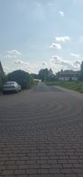
Despite noticing many no-parking zones in the southwest residential area of Groß-Zimmern, we found a streetside place to park our car.
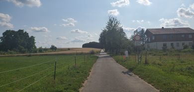
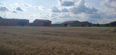
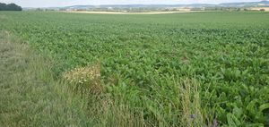
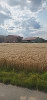
From there, it was a 1.5 kilometer walk to the hashpoint. On our way through a scenic landscape of fields and farms, we saw a lot of interesting and delightful details:
We are going on an agricultural adventure!
Untitled Goose
GameGeohashing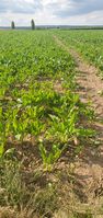
Mmmh, tasty potatoes are growing here …
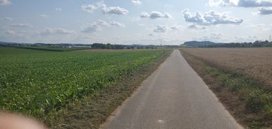
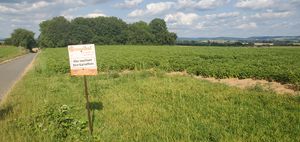
Turn left after the green-colored turnip field!


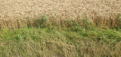
Staying on agricultural roads, we got within a radius of 50 meters from the coordinates just after 17:30. As we didn’t want to trample any turnips (out of respect for the produce, the farmer and the law), we kept our distance from the hashpoint, with myself taking some interesting photos.
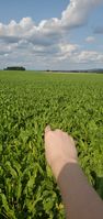
Pointing at the coordinates
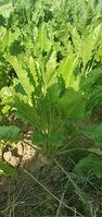
Better not trample these tender turnips!
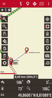
Map centered on geohash; my GPS position is on the bottom left, 50 m away from the coordinates.


While walking back to our car, we had some interesting topics to talk about while I was in awe of the whole agricultural system.
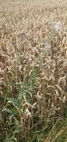
Interesting plant with foggy-looking thingies[botany terms are not easy!]
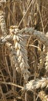
Wheat closeup
Your potatoes are growing here.
The farmer is going out with the tractor …
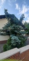
A decorative fir tree at someone’s premises that inspired my mother


Dinner time not at Thessaloniki, but at Toscana
We originally eyed a Greek restaurant, Gaststätte Thessaloniki. On the way there, we faced a roadblock and had to take a detour via side roads to then park our car nearby. However, we were let down by the fact that the restaurant took a summer break – [rant begins]just why did they not announce it on their website?! I consider this to be rude![rant ends] Thank God we saw a different, promising-looking restaurant while bypassing the roadblock earlier. We left our car parked in the same spot and walked over to Ristorante Toscana.
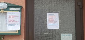
Unexpected summer break
from July 16 to August 8!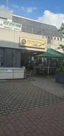
Our alternate dinner location


There, I once again enjoyed a Pizza Margherita – this time, it tasted really great! I had enough hunger to eat it whole – this doesn’t happen frequently!
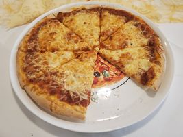
And again: Pizza Margherita for me!
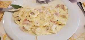
My father’s dinner: cheesy dumplings?
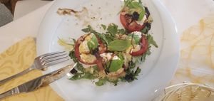
My mother’s dinner: Caprese salad

Pi: π
Z: radius
A: thickness
V: volume
V = Pi × Z × Z × A


The way back home
It went smoothly and I felt happy.
Final verdict
Agricultural awesomeness!
Postscript
On the day after the expedition, however, I was suffering from a hangover despite having slept long enough and – obviously – having stayed away from alcohol. Eating that pizza whole seemed to be the main culprit, as it likely overstrained my digestive system, causing fatigue.
Tracklog (waypoints only): Walking to the hashpoint
I forgot to start any tracklog until being close to the coordinates. Due to not being able to reach the coordinates, I decided to not record a tracklog at all.
The markers (which show all locations where I took photos) still indicate our route very well, though. (Some of the photos are taken for OpenStreetMap surveying and not uploaded here.)
Achievements
Recurring
I already earned these from an earlier geohash, but fulfilled the conditions again on this one.
Green guy! earned the OpenStreetMap achievement
|
Green guy! earned the No trespassing consolation prize
|