Difference between revisions of "2024-06-28 51 5"
MyrtleGlacy (talk | contribs) |
MyrtleGlacy (talk | contribs) |
||
| (3 intermediate revisions by the same user not shown) | |||
| Line 15: | Line 15: | ||
There was one small path in between houses that led to a dead end, but I guess it was the closest to the hash we could get. Grabbed a screen shot and a selfie and left the area. | There was one small path in between houses that led to a dead end, but I guess it was the closest to the hash we could get. Grabbed a screen shot and a selfie and left the area. | ||
| − | Luckily, it was a beautiful day. So before we went to our next hash, we visited the old Land van Ooit in Drunen. It is an abandoned amusement park. It was a very whimsical and fantastical place aimed at small children. Sadly, it was mismanaged and way to close to another amusement park, the Efteling. I included pictures of the Soldiers of Napoleon and of the Pink Castle, because they are more interesting than just pictures of some houses and a failed expedition. | + | Luckily, it was a beautiful day. So before we went to our next hash, we visited the old [https://nl.wikipedia.org/wiki/Het_Land_van_Ooit_(Drunen) Land van Ooit] in Drunen. It is an abandoned amusement park. It was a very whimsical and fantastical place aimed at small children. Sadly, it was mismanaged and way to close to another amusement park, the Efteling. I included pictures of the Soldiers of Napoleon and of the Pink Castle, because they are more interesting than just pictures of some houses and a failed expedition. |
| + | |||
| + | == Photos == | ||
| + | <gallery mode="packed" heights="250px"> | ||
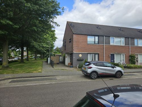
| + | 2024-06-28_51_5_House.jpeg|The houses behind which the hash was located | ||
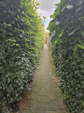
| + | 2024-06-28_51_5_A_way_in.jpeg|This path was the closest we could get, but it wasn’t enough | ||
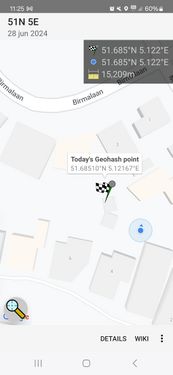
| + | 2024-06-28_51_5_App.jpeg|Close but no cigar. | ||
| + | 2024-06-28_51_5_Selfie.jpeg|Even a failed expedition deserves a selfie | ||
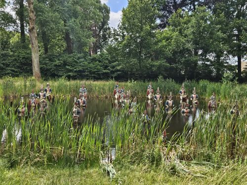
| + | 2024-06-28_51_5_Soldiers.jpeg| The lost “Soldiers of Napoleon” | ||
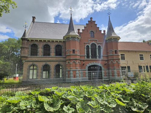
| + | 2024-06-28_51_5_The_Pink_Castle.jpeg| The previous main building of the Land van Ooit | ||
| + | </gallery> | ||
Latest revision as of 07:04, 7 August 2024
| Fri 28 Jun 2024 in 51,5: 51.6851030, 5.1216730 geohashing.info google osm bing/os kml crox |
Location
In a suburb of Drunen. Possibly reachable as the satelite image is very blurry but seems to show paths.
Participants
- MyrtleGlacy
- MyrtleGlacy's girlfriend
Expedition
We were able to borrow a car for the weekend. What better way to spend your time than see what kind of hashes the weekend will bring! We packed everything in the car for a picknick and a road trip and went on our way. The first hash of the day was in Drunen. Satellite images were unclear whether we would be able to access the hash, but there looked to be several ways to get to the area behind these houses. It looked like a small common yard in between the houses to be honest.
Reaching the block we were disappointed when we could not find a way. No paths to get in between the houses or to this mystical inner-block yard. I guess the satellites let us down this time.
There was one small path in between houses that led to a dead end, but I guess it was the closest to the hash we could get. Grabbed a screen shot and a selfie and left the area.
Luckily, it was a beautiful day. So before we went to our next hash, we visited the old Land van Ooit in Drunen. It is an abandoned amusement park. It was a very whimsical and fantastical place aimed at small children. Sadly, it was mismanaged and way to close to another amusement park, the Efteling. I included pictures of the Soldiers of Napoleon and of the Pink Castle, because they are more interesting than just pictures of some houses and a failed expedition.
