Difference between revisions of "2024-12-02 47 8"
Globescorer (talk | contribs) (→Photos) |
Globescorer (talk | contribs) (→Location) |
||
| (11 intermediate revisions by the same user not shown) | |||
| Line 1: | Line 1: | ||
{{meetup graticule|date=2024-12-02|lat=47|lon=8}} | {{meetup graticule|date=2024-12-02|lat=47|lon=8}} | ||
==Location== | ==Location== | ||
| − | This Geohash is located in a front yard of a development in | + | This Geohash is located in a front yard of a development in Buchs (ZH), Switzerland. |
==Participants== | ==Participants== | ||
| Line 12: | Line 12: | ||
Success! | Success! | ||
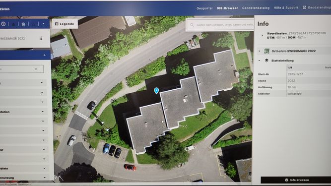
| − | + | This time it was a little more complicated than usual. When the coordinates were published, I didn't know whether they were IN FRONT OF the building or IN the building. Different aerial photos showed different results... | |
| + | |||
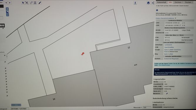
| + | In Switzerland, depending on the canton, there are different geoinformation systems that are more or less publicly accessible. Luckily, here in the canton of Zurich we have one of the best in the country: '''[https://maps.zh.ch/ GIS Browser]''' Since I work in an architectural office, I am familiar with coordinates and cadastral plans. From this portal we can download the exact borders, buildings and more and use them in our CAD systems. This data was officially measured and entered by the geometers. So these are accurate to the cm! | ||
| + | |||
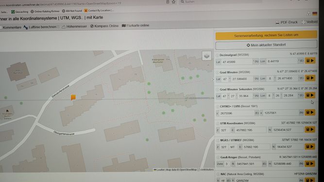
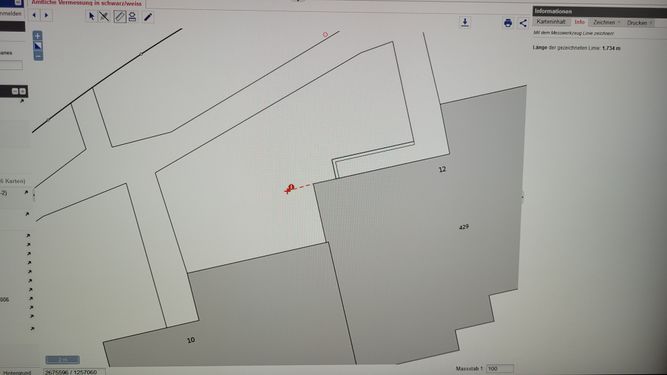
| + | So I converted the coordinates into our [https://www.swisstopo.admin.ch/de/schweizer-koordinatensystem Swiss system] and then entered them into this GIS browser. Then I was able to measure the distance to the corner of the house pretty accurately. I saw that the point was outside the building. I put all the information on a piece of paper for a possible no batteries success. | ||
| + | |||
| + | I then drove close to the address during my lunch break. A short walk around the building and I was able to claim success with a clear conscience! | ||
| + | |||
| + | Just out of curiosity, I opened the Geohash Droid app and looked at the position. I was 4.5m off the mark! And the point was finally in the building... Now this makes me uncertain for future expeditions, as my position was confirmed with the geomatics instruments, but was wrong with my smartphone. And this is probably not just because of the GPS inaccuracy... | ||
== Photos == | == Photos == | ||
<gallery mode="packed" heights="250px"> | <gallery mode="packed" heights="250px"> | ||
| − | File:2024-12-02 47 8 | + | File:2024-12-02 47 8 Koord.jpg|coordinate converter to the <b> swiss coordinates [https://www.swisstopo.admin.ch/de/schweizer-koordinatensystem LV95] </b> |
| − | File:2024-12-02 47 8 | + | File:2024-12-02 47 8 GIS 2.jpg|aerial photo in SwissImage 2022 |
| − | File:2024-12-02 47 8 | + | File:2024-12-02 47 8 GIS 1.jpg|position in the mesurement plan from the geometer |
| − | File:2024-12-02 47 8 | + | File:2024-12-02 47 8 distance.jpg|Distance from the edge of the building |
| − | File:2024-12-02 47 8 location.jpg | + | File:2024-12-02 47 8 location.jpg|hash location |
| − | File:2024-12-02 47 8 The Geohash.jpg | + | File:2024-12-02 47 8 The Geohash.jpg|The Geohash |
| − | File:2024-12-02 47 8 panorama.jpg | + | File:2024-12-02 47 8 panorama.jpg|panorama |
| − | File:2024-12-02 47 8 proof.jpg | + | File:2024-12-02 47 8 proof.jpg|no batteries documents at location |
| − | File:2024-12-02 47 8 Yeti.jpg | + | File:2024-12-02 47 8 Yeti.jpg|Nice Yeti nearby |
</gallery> | </gallery> | ||
| Line 31: | Line 39: | ||
{{#vardefine:ribbonwidth|100%}} | {{#vardefine:ribbonwidth|100%}} | ||
{{land geohash|date=2024-12-02|latitude=47|longitude=8|name=[[User:globescorer|globescorer]]|image=2024-12-02 47 8 The Geohash.jpg}} | {{land geohash|date=2024-12-02|latitude=47|longitude=8|name=[[User:globescorer|globescorer]]|image=2024-12-02 47 8 The Geohash.jpg}} | ||
| + | {{No_batteries_geohash | ||
| + | | latitude = 47 | ||
| + | | longitude = 8 | ||
| + | | date = 2024-12-02 | ||
| + | | name = [[User:globescorer|globescorer]] | ||
| + | }} | ||
{{location|CH|ZH}} | {{location|CH|ZH}} | ||
Latest revision as of 08:19, 3 December 2024
| Mon 2 Dec 2024 in 47,8: 47.4599884, 8.4411905 geohashing.info google osm bing/os kml crox |
Location
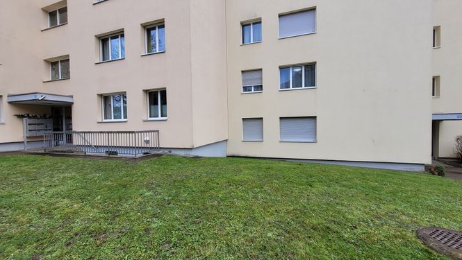
This Geohash is located in a front yard of a development in Buchs (ZH), Switzerland.
Participants
Plans
Visiting this geohash in my lunchtime.
Expedition
Success!
This time it was a little more complicated than usual. When the coordinates were published, I didn't know whether they were IN FRONT OF the building or IN the building. Different aerial photos showed different results...
In Switzerland, depending on the canton, there are different geoinformation systems that are more or less publicly accessible. Luckily, here in the canton of Zurich we have one of the best in the country: GIS Browser Since I work in an architectural office, I am familiar with coordinates and cadastral plans. From this portal we can download the exact borders, buildings and more and use them in our CAD systems. This data was officially measured and entered by the geometers. So these are accurate to the cm!
So I converted the coordinates into our Swiss system and then entered them into this GIS browser. Then I was able to measure the distance to the corner of the house pretty accurately. I saw that the point was outside the building. I put all the information on a piece of paper for a possible no batteries success.
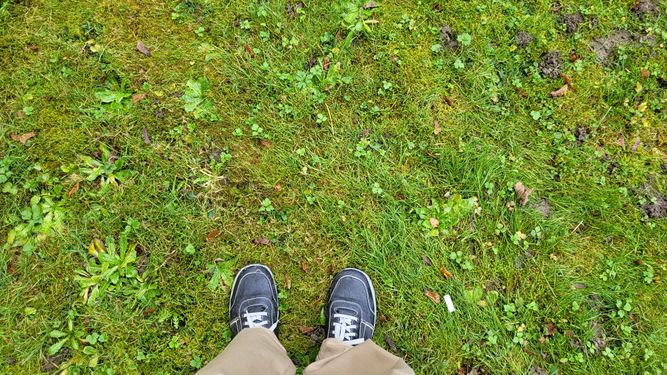
I then drove close to the address during my lunch break. A short walk around the building and I was able to claim success with a clear conscience!
Just out of curiosity, I opened the Geohash Droid app and looked at the position. I was 4.5m off the mark! And the point was finally in the building... Now this makes me uncertain for future expeditions, as my position was confirmed with the geomatics instruments, but was wrong with my smartphone. And this is probably not just because of the GPS inaccuracy...
Photos
coordinate converter to the swiss coordinates LV95
Achievements
globescorer earned the Land geohash achievement
|
globescorer earned the No Batteries Geohash Achievement
|
