Difference between revisions of "2009-06-15 49 8"
imported>Ilpadre m (→Preliminary visit on 2009-06-14) |
imported>Ilpadre (→Preliminary visit on 2009-06-14: +panorama) |
||
| Line 20: | Line 20: | ||
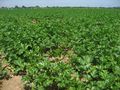
A popular cycling route is as close as 300 m to the hashpoint, so I've already been near the coordinates a couple of times. The weather on Sunday was great, so I cycled to Neurott and checked whether the coordinates would be accessible on Monday (they are - I'll be able to walk between the lines of potato plants). | A popular cycling route is as close as 300 m to the hashpoint, so I've already been near the coordinates a couple of times. The weather on Sunday was great, so I cycled to Neurott and checked whether the coordinates would be accessible on Monday (they are - I'll be able to walk between the lines of potato plants). | ||
| + | |||
| + | [[Image:2009-06-15 49 8 neurottpano.jpg|left|600px]] | ||
<gallery> | <gallery> | ||
Revision as of 12:31, 14 June 2009
| Mon 15 Jun 2009 in Mannheim: 49.3639384, 8.6272194 geohashing.info google osm bing/os kml crox |
Where?
The coordinates are in a field in Neurott, a small (60 inhabitants) rural community founded in 1937 as one of the first agricultural settlements in Baden-Württemberg. Trivia: Neurott lacked a proper wastewater treatment system (since it is cut off from the main sewer network) until Germany's first membrane wastewater treatment plant was installed here in 2005.
Neurott is located about 7 km from central Heidelberg. It's within a stone's throw of Patrick Henry Village.
ilpadre
A great opportunity to get another Walk Geohash for my collection!
Preliminary visit on 2009-06-14
A popular cycling route is as close as 300 m to the hashpoint, so I've already been near the coordinates a couple of times. The weather on Sunday was great, so I cycled to Neurott and checked whether the coordinates would be accessible on Monday (they are - I'll be able to walk between the lines of potato plants).

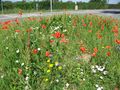
Flowers at Speyerer Str.
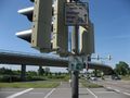
That cycling route leads all the way to the Bodensee
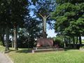
You love one another as I loved you. John 15,12
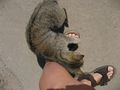
Cat at a nearby farm
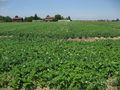
Parsley field

The coordinates as seen from the bridge
The bridge as seen from the coordinates
The hashpoint


