Difference between revisions of "2009-11-03 41 -72"
From Geohashing
imported>Sara (I really want to do a few more Bike Geohashes before the snow comes.) |
imported>FippeBot m (Location) |
||
| Line 50: | Line 50: | ||
[[Category:Coordinates not reached]] | [[Category:Coordinates not reached]] | ||
[[Category:Not reached - No public access]] | [[Category:Not reached - No public access]] | ||
| + | {{location|US|CT|HA}} | ||
Latest revision as of 06:39, 8 August 2019
| Tue 3 Nov 2009 in 41,-72: 41.8987364, -72.5334799 geohashing.info google osm bing/os kml crox |
Location
In the trees at the edge of a field in East Windsor, Connecticut.
Participants
Expedition
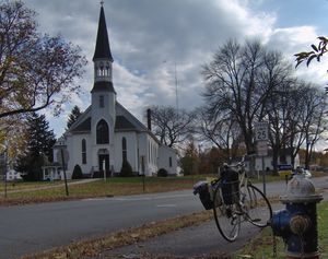
This was a really fun 40.5km bike ride, my longest bike ride ever. It took me just under four hours. I didn't make it to the hashpoint due to a No Trespassing sign, but I saw a lot of interesting stuff.
Photos
On the Way There
On the Way Home
Just to keep it inetersting, I did this tron-style, going home by a different route. (Even if I had made it, this would not have officially been a tron achievement - I'm too lazy to avoid crossing my path when I get off the bike to take pictures.)


