Difference between revisions of "2010-10-04 51 11"
From Geohashing
imported>Reinhard (report) |
imported>Reinhard (gallery) |
||
| Line 18: | Line 18: | ||
== Photos == | == Photos == | ||
{{gallery|width=200|height=200|lines=2 | {{gallery|width=200|height=200|lines=2 | ||
| − | |Image:20101004-51N11E-01.jpg| | + | |Image:20101004-51N11E-01.jpg|View towards the hashpoint. |
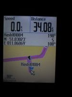
| − | |Image:20101004-51N11E- | + | |Image:20101004-51N11E-02.jpg|108 m to go. |
}} | }} | ||
Revision as of 21:55, 7 October 2010
| Mon 4 Oct 2010 in 51,11: 51.0302292, 11.8606864 geohashing.info google osm bing/os kml crox |
Location
100 m into a field near Pratschütz in Thuringia.
Participants
Expedition
Reinhard cycled there in the evening, but the digged field was too muddy for Reinhard's bike shoes, so he stayed at the edge. Altogether 79 km.
Photos
|

