Difference between revisions of "2011-04-01 34 -83"
From Geohashing
imported>Tomkf61 (→Participants) |
imported>Tomkf61 (→Photos) |
||
| Line 41: | Line 41: | ||
--> | --> | ||
<gallery perrow="5"> | <gallery perrow="5"> | ||
| + | |||
| + | File:2011-04-01_34_-83_Hash02.jpg| Hash 2011-04-01 34 -83. | ||
| + | File:2011-04-01_34_-83_Hash01.jpg| Hash 2011-04-01 34 -83. | ||
| + | File:2011-04-01_34_-83_StupidGrin01.jpg| Stupid Grin. | ||
| + | File:2011-04-01_34_-83_Parked_Here.jpg| Where I parked. | ||
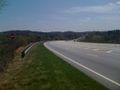
| + | File:2011-04-01_34_-83_Hwy17_01.jpg| View down Hwy 17. | ||
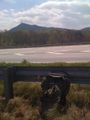
| + | File:2011-04-01_34_-83_Currahee01.jpg| View of Currahee Mountain. (South) | ||
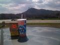
| + | File:2011-04-01_34_-83_GeoTrash01.jpg| GeoTrash cleanup. | ||
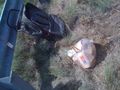
| + | File:2011-04-01_34_-83_GeoSquishy01.jpg| GeoSquishy (Currahee Mtn in distance). | ||
| + | File:2011-04-01_34_-83_ToccoaGA02.jpg| Stephens Co., GA Courthouse. | ||
| + | File:2011-04-01_34_-83_Tallulah02.jpg| View of Tallulah Gorge. | ||
| + | |||
</gallery> | </gallery> | ||
Revision as of 01:46, 2 April 2011
| Fri 1 Apr 2011 in 34,-83: 34.5523773, -83.3726063 geohashing.info google osm bing/os kml crox |
Location
On north side of Highway 17 (Toccoa Bypass), 4.75 kilometers from Toccoa, GA.
Participants
Plans
Expedition
Tracklog
Photos
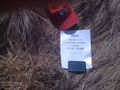
Hash 2011-04-01 34 -83.
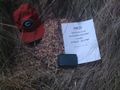
Hash 2011-04-01 34 -83.
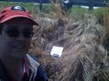
Stupid Grin.
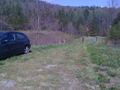
Where I parked.
View down Hwy 17.
View of Currahee Mountain. (South)
GeoTrash cleanup.
GeoSquishy (Currahee Mtn in distance).

Stephens Co., GA Courthouse.
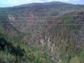
View of Tallulah Gorge.


Achievements