Difference between revisions of "2012-01-11 59 17"
imported>Cjk |
imported>Cjk |
||
| Line 20: | Line 20: | ||
Right next to Österleden outside Enköping. | Right next to Österleden outside Enköping. | ||
| − | If you take exit | + | If you take exit 143 from the E18, then right and left into Österleden, it is beside the [https://maps.google.com/maps?q=59.6358341,+17.1434326+(Geohashing+for+11+Jan+2012+in+59,17)&hl=en&ll=59.635845,17.143435&spn=0.001026,0.002162&t=h&z=19&vpsrc=6 road] right by a [https://maps.google.com/maps?q=59.6358341,+17.1434326+(Geohashing+for+11+Jan+2012+in+59,17)&hl=en&ll=59.635845,17.143435&spn=0.001026,0.002162&t=h&z=19&vpsrc=6 rock]. |
== Participants == | == Participants == | ||
<!-- who attended --> | <!-- who attended --> | ||
[[User:Cjk | Carl-Johan]] | [[User:Cjk | Carl-Johan]] | ||
| − | |||
| − | |||
| − | |||
| − | |||
== Expedition == | == Expedition == | ||
<!-- how it all turned out. your narrative goes here. --> | <!-- how it all turned out. your narrative goes here. --> | ||
| − | + | I was going to pickup my dad and stepmom at Arlanda airport anyway today so a quick geohash on the way would be nice. High speed drive towards enköping and took exit 143 and headed onto Österleden. I had memorized the trees and rocks from google street view, turned the car around so I was heading north and found the spot. Rolled until I was on the exact lattitude (a few meters) and got out and took some nice pictures. Then off to the airport. | |
| − | |||
| − | |||
== Photos == | == Photos == | ||
| Line 41: | Line 35: | ||
--> | --> | ||
<gallery perrow="5"> | <gallery perrow="5"> | ||
| + | Image:2012-01-11_59_17_01.jpg | GPS | ||
| + | Image:2012-01-11_59_17_02.jpg | View out the window. Compare to [https://maps.google.com/maps?q=59.6358341,+17.1434326+(Geohashing+for+11+Jan+2012+in+59,17)&hl=en&ll=59.635807,17.143293&spn=0.001026,0.002162&t=h&z=19&vpsrc=6&layer=c&cbll=59.635931,17.143177&panoid=tL2yCpef5CRpeMDLSr-L0Q&cbp=12,88.92,,1,-2.12 Street View]. Pretty exact eh? | ||
| + | Image:2012-01-11_59_17_03.jpg | My car from spot. | ||
| + | Image:2012-01-11_59_17_04.jpg | Me with grin. | ||
| + | Image:2012-01-11_59_17_05.jpg | My first picture in a series of me at hash points with T-shirts of obscure bands. This is [http://bttls.com/ Battles]! | ||
</gallery> | </gallery> | ||
Revision as of 16:41, 11 January 2012

| Wed 11 Jan 2012 in 59,17: 59.6358341, 17.1434326 geohashing.info google osm bing/os kml crox |
Location
Right next to Österleden outside Enköping.
If you take exit 143 from the E18, then right and left into Österleden, it is beside the road right by a rock.
Participants
Expedition
I was going to pickup my dad and stepmom at Arlanda airport anyway today so a quick geohash on the way would be nice. High speed drive towards enköping and took exit 143 and headed onto Österleden. I had memorized the trees and rocks from google street view, turned the car around so I was heading north and found the spot. Rolled until I was on the exact lattitude (a few meters) and got out and took some nice pictures. Then off to the airport.
Photos
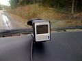
GPS
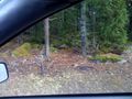
View out the window. Compare to Street View. Pretty exact eh?
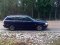
My car from spot.

Me with grin.

My first picture in a series of me at hash points with T-shirts of obscure bands. This is Battles!


Achievements