Difference between revisions of "2012-02-29 42 -71"
imported>Phyzome (planning: woods, driveway) |
imported>Phyzome (trek part 1 of 3) |
||
| Line 30: | Line 30: | ||
== Expedition == | == Expedition == | ||
| − | |||
| − | + | Phyzome: | |
| − | + | ||
| + | I left work at around 4:45 PM EST, taking the Red Line to Park Street, then the Green Line (D/Riverside) out to Brookline Hills. My planning was kind of terrible, so my photos of Google Maps (which I use in lieu of a proper streetmap-integrated GPS) did not include how to get from the T station to bus 60. By the time I figured it out (using a map I still had loaded in my browser on my laptop) I had just missed the bus, and had to wait for about 20 minutes. The bus dropped me off in some commercial mall-hell thingy, and I wandered down to "Boylston St", which is a highway in its own right at that point, and started west. My old, crappy GPS didn't see much in the way of satellites, but I knew my turn-off to the south was Dudley Rd. | ||
| + | |||
| + | As I walked west, I noted the fence running down the middle of the divided highway. I really should have paid more attention to that. I only encountered one crossing, halfway to Dudley Rd... *including* Dudley Rd. Oops! Backtrack, cross, walk west again. Finally. | ||
| + | |||
| + | The second photo of the gallery is there to commemorate my learning two lessons: | ||
| + | |||
| + | # Cross highways as soon as possible, you may not get another chance | ||
| + | # Dial down the flash when photographing retroreflective materials | ||
== Photos == | == Photos == | ||
| − | |||
| − | |||
| − | |||
<gallery perrow="5"> | <gallery perrow="5"> | ||
| + | Image:2012-02-29 42 -71 waiting for bus.jpg | Waiting for the bus | ||
| + | Image:2012-02-29 42 -71 hasher-proof fence.jpg | 2 lessons learned | ||
</gallery> | </gallery> | ||
| − | |||
| − | |||
| − | |||
| − | |||
| − | |||
| − | |||
| − | |||
[[Category:Expeditions]] | [[Category:Expeditions]] | ||
| − | |||
[[Category:Expeditions with photos]] | [[Category:Expeditions with photos]] | ||
| − | |||
| − | |||
| − | |||
| − | |||
| − | |||
| − | |||
| − | |||
| − | |||
| − | |||
[[Category:Coordinates not reached]] | [[Category:Coordinates not reached]] | ||
| − | |||
| − | |||
| − | |||
| − | |||
| − | |||
| − | |||
Revision as of 03:16, 1 March 2012
| Wed 29 Feb 2012 in 42,-71: 42.3129303, -71.1794689 geohashing.info google osm bing/os kml crox |
Location
- Probably on someone's driveway
- Near Lost Pond Reservation
- Border of Newton, MA and Brookline, MA
Participants
- Phyzome plans to attend -- poke on IRC or userpage to coordinate!
Plans
- Phyzome: I plan on taking the Green Line out after work, maybe starting around 4:30. I'll either walk from there or take bus 60 to get closer. If I walk through the woods, I can shave 0.7 miles off the walk from the Green Line. Will bring chocolate.
Expedition
Phyzome:
I left work at around 4:45 PM EST, taking the Red Line to Park Street, then the Green Line (D/Riverside) out to Brookline Hills. My planning was kind of terrible, so my photos of Google Maps (which I use in lieu of a proper streetmap-integrated GPS) did not include how to get from the T station to bus 60. By the time I figured it out (using a map I still had loaded in my browser on my laptop) I had just missed the bus, and had to wait for about 20 minutes. The bus dropped me off in some commercial mall-hell thingy, and I wandered down to "Boylston St", which is a highway in its own right at that point, and started west. My old, crappy GPS didn't see much in the way of satellites, but I knew my turn-off to the south was Dudley Rd.
As I walked west, I noted the fence running down the middle of the divided highway. I really should have paid more attention to that. I only encountered one crossing, halfway to Dudley Rd... *including* Dudley Rd. Oops! Backtrack, cross, walk west again. Finally.
The second photo of the gallery is there to commemorate my learning two lessons:
- Cross highways as soon as possible, you may not get another chance
- Dial down the flash when photographing retroreflective materials
Photos
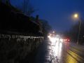
Waiting for the bus
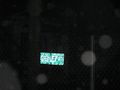
2 lessons learned

