Difference between revisions of "2012-06-04 48 7"
From Geohashing
imported>Frizzy ([live picture] Frizzy + bike... [http://www.openstreetmap.org/?lat=48.02205755&lon=7.79403361&zoom=16&layers=B000FTF @48.0221,7.7940]) |
imported>Frizzy ([live picture] ...on their way to Gottenheim. [http://www.openstreetmap.org/?lat=48.03617909&lon=7.76171509&zoom=16&layers=B000FTF @48.0362,7.7617]) |
||
| Line 51: | Line 51: | ||
Image:2012-06-04_48_7_17-50-54-468.jpg | Frizzy + bike... [http://www.openstreetmap.org/?lat=48.02205755&lon=7.79403361&zoom=16&layers=B000FTF @48.0221,7.7940] | Image:2012-06-04_48_7_17-50-54-468.jpg | Frizzy + bike... [http://www.openstreetmap.org/?lat=48.02205755&lon=7.79403361&zoom=16&layers=B000FTF @48.0221,7.7940] | ||
| + | |||
| + | Image:2012-06-04_48_7_18-07-37-701.jpg | ...on their way to Gottenheim. [http://www.openstreetmap.org/?lat=48.03617909&lon=7.76171509&zoom=16&layers=B000FTF @48.0362,7.7617] | ||
</gallery> | </gallery> | ||
Revision as of 16:08, 4 June 2012
| Mon 4 Jun 2012 in 48,7: 48.0458348, 7.7443343 geohashing.info google osm bing/os kml crox |
Location
In a forest near Gottenheim.
Participants
Plans
We want to go there by bike tomorrow evening after work, because one way will only be around 10 kms.
- Hijackal
- Will try to leave work by bike at 18:00, which would result in arrival at the hash at about 18:45
Expedition
- I am starting the expedition now though rainy and stormy weather :-) -- Frizzy @48.0026,7.8501 17:23, 4 June 2012 (GMT+02:00)
Tracklog
Photos
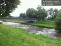
Dreisam river on my way to the hash. @48.0172,7.7981

Frizzy + bike... @48.0221,7.7940
...on their way to Gottenheim. @48.0362,7.7617


Achievements