Difference between revisions of "2012-07-27 59 12"
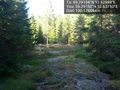
imported>Cjk (The creek that fills the swamp by the car [http://www.openstreetmap.org/?lat=59.29180000&lon=12.63250000&zoom=16&layers=B000FTF @59.2918,12.6325]) |
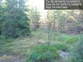
imported>Cjk (Sparse spruce trees [http://www.openstreetmap.org/?lat=59.29200000&lon=12.63290000&zoom=16&layers=B000FTF @59.2920,12.6329]) |
||
| Line 84: | Line 84: | ||
Image:2012-07-27_59_12_00-31-18-918.jpg | The creek that fills the swamp by the car [http://www.openstreetmap.org/?lat=59.29180000&lon=12.63250000&zoom=16&layers=B000FTF @59.2918,12.6325] | Image:2012-07-27_59_12_00-31-18-918.jpg | The creek that fills the swamp by the car [http://www.openstreetmap.org/?lat=59.29180000&lon=12.63250000&zoom=16&layers=B000FTF @59.2918,12.6325] | ||
| + | |||
| + | Image:2012-07-27_59_12_00-32-07-318.jpg | Sparse spruce trees [http://www.openstreetmap.org/?lat=59.29200000&lon=12.63290000&zoom=16&layers=B000FTF @59.2920,12.6329] | ||
</gallery> | </gallery> | ||
Revision as of 22:32, 27 July 2012
| Fri 27 Jul 2012 in Arvika: 59.2910436, 12.6299855 geohashing.info google osm bing/os kml crox |
Location
Participants
Plans
Expedition
- In Karlstad -- Cjk @59.3834,13.4762 18:46, 27 July 2012 (CEST)
- Damn swamp, feet wet, deflowered -- Cjk @59.2911,12.6300 19:41, 27 July 2012 (CEST)
Tracklog
Photos

Made it, with Campanja T-shirt @59.2911,12.6299

Only 448 m to go from this unknown road @59.2948,12.6328
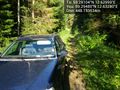
The car in these woods @59.2948,12.6328
It's in there somewhere @59.2948,12.6328
It was a swamp, tried it, tried to jump back, landed in this ditch and soaked my shoes so wtf, let's just cross this swamp! @59.2946,12.6330
Marsh, swamp, wet feet. @59.2946,12.6330

The logging machines have used this path @59.2941,12.6330
Oh look, blueberries!!! Yummy! @59.2931,12.6328

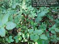
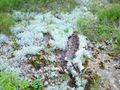
These leaves are my fav, tart and refreshing. 'Harsyra' @59.2927,12.6329

Made it. Marked it with orange(TM) @59.2911,12.6299
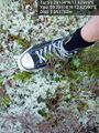
My soaked through converse at the spot @59.2911,12.6299
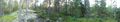
Panorama 1
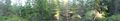
Panorama 2
Wet moss doesn't have the best footing.slipped and almost fell.
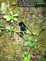
Black slug, not the invading brown murder slug. @59.2911,12.6306
First clearing on the way back @59.2912,12.6309
Second clearing @59.2915,12.6315
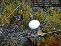
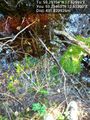
Ooo, an egg. @59.2918,12.6323
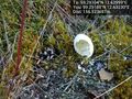
Bugger, already empty @59.2918,12.6323
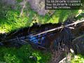
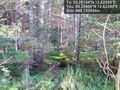
The creek that fills the swamp by the car @59.2918,12.6325
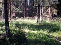
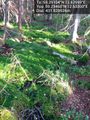
Sparse spruce trees @59.2920,12.6329


Achievements