Difference between revisions of "2013-02-22 49 9"
imported>Chemluth (Created page with "{{subst:Expedition |lat = 49 |lon = 9 |date = 2013-02-22 }}") |
imported>Chemluth |
||
| Line 18: | Line 18: | ||
__NOTOC__ | __NOTOC__ | ||
== Location == | == Location == | ||
| + | The geohash was on a steep bank of a small stream 30 down from the trail near Fahrenbach. | ||
<!-- where you've surveyed the hash to be --> | <!-- where you've surveyed the hash to be --> | ||
== Participants == | == Participants == | ||
| + | only me [[User:Chemluth|Chemluth]] ([[User talk:Chemluth|talk]]) | ||
<!-- who attended: If you link to your wiki user name in this section, your expedition will be picked up by the various statistics generated for geohashing. You may use three tildes ~ as a shortcut to automatically insert the user signature of the account you are editing with. | <!-- who attended: If you link to your wiki user name in this section, your expedition will be picked up by the various statistics generated for geohashing. You may use three tildes ~ as a shortcut to automatically insert the user signature of the account you are editing with. | ||
--> | --> | ||
== Plans == | == Plans == | ||
| + | I plnned to make this Geohash during my lunchbreak because it was only nine Kilometers away. But them my break was cut short and i did it in the evening. | ||
<!-- what were the original plans --> | <!-- what were the original plans --> | ||
== Expedition == | == Expedition == | ||
| + | I parked my car in Fahrenbach in a street called Wandelgewann (medival german for "places for just wandering around") and quickly fund the forest trail that i´ve seen on the satalite pictures. After a few minutes of walking I had to leaf the trail and go down the bank of the stream. The hashpoint was just above the stream. I the point would have been 5 meters further down the bank i could have claimed a achiefment for extremly cold wet feet. | ||
<!-- how it all turned out. your narrative goes here. --> | <!-- how it all turned out. your narrative goes here. --> | ||
| Line 38: | Line 42: | ||
--> | --> | ||
<gallery perrow="5"> | <gallery perrow="5"> | ||
| + | Image:201-02-22 49 09 Lamda.jpg | The Lamda sign i left. (Yes i´m a half-life fan) | ||
| + | Image::2013-02-22 49 09 Me.jpg | not really a proof | ||
</gallery> | </gallery> | ||
== Achievements == | == Achievements == | ||
| + | I could claim "Land geohash achievment" but i forgot to collect the required proof. I only have a screenshot of Geohashdroid, some photos and i left a lambda sign on the hashpoint. | ||
{{#vardefine:ribbonwidth|800px}} | {{#vardefine:ribbonwidth|800px}} | ||
<!-- Add any achievement ribbons you earned below, or remove this section --> | <!-- Add any achievement ribbons you earned below, or remove this section --> | ||
Revision as of 14:41, 24 February 2013
| Fri 22 Feb 2013 in 49,9: 49.4355380, 9.1595873 geohashing.info google osm bing/os kml crox |
Location
The geohash was on a steep bank of a small stream 30 down from the trail near Fahrenbach.
Participants
Plans
I plnned to make this Geohash during my lunchbreak because it was only nine Kilometers away. But them my break was cut short and i did it in the evening.
Expedition
I parked my car in Fahrenbach in a street called Wandelgewann (medival german for "places for just wandering around") and quickly fund the forest trail that i´ve seen on the satalite pictures. After a few minutes of walking I had to leaf the trail and go down the bank of the stream. The hashpoint was just above the stream. I the point would have been 5 meters further down the bank i could have claimed a achiefment for extremly cold wet feet.
Tracklog
Photos
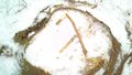
The Lamda sign i left. (Yes i´m a half-life fan)

Achievements
I could claim "Land geohash achievment" but i forgot to collect the required proof. I only have a screenshot of Geohashdroid, some photos and i left a lambda sign on the hashpoint.