Difference between revisions of "2013-03-31 38 -77"
From Geohashing
imported>Jiml m (Tag as planning page) |
imported>OfficeLinebacker ([live picture] De-nied [http://www.openstreetmap.org/?lat=38.72180552&lon=-77.16256740&zoom=16&layers=B000FTF @38.7218,-77.1626]) |
||
| Line 41: | Line 41: | ||
--> | --> | ||
<gallery perrow="5"> | <gallery perrow="5"> | ||
| + | |||
| + | Image:2013-03-31_38_-77_10-24-54-564.jpg | De-nied [http://www.openstreetmap.org/?lat=38.72180552&lon=-77.16256740&zoom=16&layers=B000FTF @38.7218,-77.1626] | ||
</gallery> | </gallery> | ||
Revision as of 14:24, 31 March 2013
| Sun 31 Mar 2013 in 38,-77: 38.7312575, -77.1379917 geohashing.info google osm bing/os kml crox |
Location
About 200 feet into the woods off of John J Kingman road in Fort Belvoir Virginia
Participants
- OfficeLinebacker
- Allison
Plans
Expedition
Tracklog
Photos
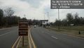
De-nied @38.7218,-77.1626

Achievements