Difference between revisions of "2014-02-06 54 -2"
From Geohashing
imported>Angel (Aborted due to low blood sugar :( [http://www.openstreetmap.org/?lat=54.06670000&lon=-2.78320000&zoom=16&layers=B000FTF @54.0667,-2.7832]) |
imported>Angel |
||
| Line 19: | Line 19: | ||
== Location == | == Location == | ||
<!-- where you've surveyed the hash to be --> | <!-- where you've surveyed the hash to be --> | ||
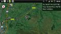
| + | In a field somewhere off a road past Halton. | ||
== Participants == | == Participants == | ||
<!-- who attended: If you link to your wiki user name in this section, your expedition will be picked up by the various statistics generated for geohashing. You may use three tildes ~ as a shortcut to automatically insert the user signature of the account you are editing with. | <!-- who attended: If you link to your wiki user name in this section, your expedition will be picked up by the various statistics generated for geohashing. You may use three tildes ~ as a shortcut to automatically insert the user signature of the account you are editing with. | ||
--> | --> | ||
| + | [[User:Angel|Angel]] ([[User talk:Angel|talk]]) | ||
== Plans == | == Plans == | ||
<!-- what were the original plans --> | <!-- what were the original plans --> | ||
| + | Walk up the cyclepath, see if I can get there, return to Lancaster via Quernmore. | ||
== Expedition == | == Expedition == | ||
<!-- how it all turned out. your narrative goes here. --> | <!-- how it all turned out. your narrative goes here. --> | ||
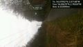
| + | Went part way; blood sugar went low; panicked and aborted with 4.5 miles to go. | ||
== Tracklog == | == Tracklog == | ||
| Line 58: | Line 62: | ||
--> | --> | ||
| − | |||
[[Category:Expeditions]] | [[Category:Expeditions]] | ||
| − | |||
[[Category:Expeditions with photos]] | [[Category:Expeditions with photos]] | ||
| − | |||
| − | |||
| − | |||
| − | |||
| − | |||
| − | |||
| − | |||
| − | |||
[[Category:Coordinates not reached]] | [[Category:Coordinates not reached]] | ||
| − | |||
| − | |||
| − | |||
| − | |||
| − | |||
| − | |||
| − | |||
| − | |||
| − | |||
| − | |||
| − | |||
| − | |||
| − | |||
| − | |||
Revision as of 23:23, 6 February 2014
| Thu 6 Feb 2014 in 54,-2: 54.0709214, -2.6714825 geohashing.info google osm bing/os kml crox |
Location
In a field somewhere off a road past Halton.
Participants
Plans
Walk up the cyclepath, see if I can get there, return to Lancaster via Quernmore.
Expedition
Went part way; blood sugar went low; panicked and aborted with 4.5 miles to go.
Tracklog
Photos
Pretty sure this'll end up 'private property', but must be worth a try @54.0538,-2.7910
Aborted due to low blood sugar :( @54.0667,-2.7832

