Difference between revisions of "2014-05-24 47 11"
From Geohashing
imported>LeslieHapablap (→Plans) |
imported>LeslieHapablap |
||
| Line 2: | Line 2: | ||
<!-- If you did not specify these parameters in the template, please substitute appropriate values for IMAGE, LAT, LON, and DATE (YYYY-MM-DD format) | <!-- If you did not specify these parameters in the template, please substitute appropriate values for IMAGE, LAT, LON, and DATE (YYYY-MM-DD format) | ||
| − | [[Image:{{{image|IMAGE}}}|thumb| | + | [[Image:{{{image|IMAGE}}}|thumb|right]] |
Remove this section if you don't want an image at the top (left) of your report. You should remove the "Image:" or "File:" | Remove this section if you don't want an image at the top (left) of your report. You should remove the "Image:" or "File:" | ||
Revision as of 21:40, 23 May 2014
| Sat 24 May 2014 in 47,11: 47.3266421, 11.7578641 geohashing.info google osm bing/os kml crox |
Location
Above Schwaz near Proxnalm.
Participants
- LeslieHapablap
- Waltraud the hashkiwi.
Plans
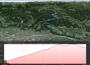
Go to Schwaz, then hike up the mountain to the hashpoint (planned arrival at 1 pm). Maybe walk the additional 2 km to Proxnalm for a lunch. If everything goes well, this is the first of four consecutive expeditions in the next four days. We were not blessed with many good points during the last couple of months, but this weekend plus Monday and Tuesday have awesome hashpoints.
Expedition
- Will go. -- LeslieHapablap (talk) 17:25, 23 May 2014 (EDT)
Tracklog
Photos
Achievements
