Difference between revisions of "2014-08-03 38 -76"
From Geohashing
imported>OfficeLinebacker ([live picture] Crossing the Severn River [http://www.openstreetmap.org/?lat=39.00780000&lon=-76.50250000&zoom=16&layers=B000FTF @39.0078,-76.5025]) |
imported>OfficeLinebacker ([live picture] Crossing the Bay Bridge [http://www.openstreetmap.org/?lat=39.00080000&lon=-76.39950000&zoom=16&layers=B000FTF @39.0008,-76.3995]) |
||
| Line 42: | Line 42: | ||
Image:2014-08-03_38_-76_12-35-05-367.jpg | Crossing the Severn River [http://www.openstreetmap.org/?lat=39.00780000&lon=-76.50250000&zoom=16&layers=B000FTF @39.0078,-76.5025] | Image:2014-08-03_38_-76_12-35-05-367.jpg | Crossing the Severn River [http://www.openstreetmap.org/?lat=39.00780000&lon=-76.50250000&zoom=16&layers=B000FTF @39.0078,-76.5025] | ||
| + | |||
| + | Image:2014-08-03_38_-76_12-48-25-934.jpg | Crossing the Bay Bridge [http://www.openstreetmap.org/?lat=39.00080000&lon=-76.39950000&zoom=16&layers=B000FTF @39.0008,-76.3995] | ||
</gallery> | </gallery> | ||
Revision as of 16:50, 3 August 2014
| Sun 3 Aug 2014 in 38,-76: 38.9887592, -76.3096274 geohashing.info google osm bing/os kml crox |
Location
Participants
Plans
Expedition
- On our way to this one. Near the athletic fields at Kent Island High School. -- OfficeLinebacker (talk) 11:48, 3 August 2014 (EDT)
Tracklog
Photos
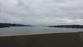
Crossing the Severn River @39.0078,-76.5025
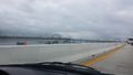
Crossing the Bay Bridge @39.0008,-76.3995


Achievements