Difference between revisions of "2014-12-19 47 -117"
From Geohashing
imported>Thomcat ([live picture] The view from atop the bluff [http://www.openstreetmap.org/?lat=47.69005477&lon=-117.42771141&zoom=16&layers=B000FTF @47.6901,-117.4277]) |
imported>Thomcat ([live picture] View from atop the bluff [http://www.openstreetmap.org/?lat=47.69005993&lon=-117.42770208&zoom=16&layers=B000FTF @47.6901,-117.4277]) |
||
| Line 44: | Line 44: | ||
Image:2014-12-19_47_-117_thomcat_1419028320325.jpg | The view from atop the bluff [http://www.openstreetmap.org/?lat=47.69005477&lon=-117.42771141&zoom=16&layers=B000FTF @47.6901,-117.4277] | Image:2014-12-19_47_-117_thomcat_1419028320325.jpg | The view from atop the bluff [http://www.openstreetmap.org/?lat=47.69005477&lon=-117.42771141&zoom=16&layers=B000FTF @47.6901,-117.4277] | ||
| + | |||
| + | Image:2014-12-19_47_-117_thomcat_1419028320325.jpg | View from atop the bluff [http://www.openstreetmap.org/?lat=47.69005993&lon=-117.42770208&zoom=16&layers=B000FTF @47.6901,-117.4277] | ||
</gallery> | </gallery> | ||
Revision as of 22:33, 19 December 2014
| Fri 19 Dec 2014 in 47,-117: 47.6897705, -117.4286453 geohashing.info google osm bing/os kml crox |
Location
Participants
Plans
Expedition
Tracklog
Photos
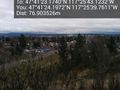
The view from atop the bluff @47.6901,-117.4277
View from atop the bluff @47.6901,-117.4277


Achievements