Difference between revisions of "2016-05-23 49 11"
From Geohashing
imported>Schnatterfleck ([live picture]View of Almoshof, Some of the Nürnberg Skyline in the background. [http://www.openstreetmap.org/?lat=49.46671620&lon=11.04424380&zoom=16&layers=B000FTF @49.4667,11.0442]) |
imported>Schnatterfleck ([live picture]The area near the airport grows some of the best strawberrys I ever tasted. [http://www.openstreetmap.org/?lat=49.46673300&lon=11.04425120&zoom=16&layers=B000FTF @49.4667,11.0443]) |
||
| Line 58: | Line 58: | ||
Image:2016-05-23_49_11_Schnatterfleck_1464031786496.jpg|View of Almoshof, Some of the Nürnberg Skyline in the background. [http://www.openstreetmap.org/?lat=49.46671620&lon=11.04424380&zoom=16&layers=B000FTF @49.4667,11.0442] | Image:2016-05-23_49_11_Schnatterfleck_1464031786496.jpg|View of Almoshof, Some of the Nürnberg Skyline in the background. [http://www.openstreetmap.org/?lat=49.46671620&lon=11.04424380&zoom=16&layers=B000FTF @49.4667,11.0442] | ||
| + | |||
| + | Image:2016-05-23_49_11_Schnatterfleck_1464031888462.jpg|The area near the airport grows some of the best strawberrys I ever tasted. [http://www.openstreetmap.org/?lat=49.46673300&lon=11.04425120&zoom=16&layers=B000FTF @49.4667,11.0443] | ||
</gallery> | </gallery> | ||
Revision as of 19:31, 23 May 2016
| Mon 23 May 2016 in 49,11: 49.4933109, 11.0791717 geohashing.info google osm bing/os kml crox |
Location
Participants
Plans
Expedition
Tracklog
Photos
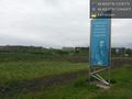
On the way - with best regards from Albrecht Dürer @49.4667,11.0442
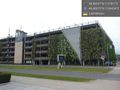
Hashpoint somewhere in the middle of this building. @49.4667,11.0442
Building is a parking house, so entrace is possible!
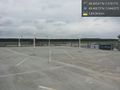
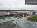
At hashpoint - roof level. @49.4667,11.0442
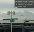
More than excellent mobile reception at the hashpoint:-) @49.4667,11.0442
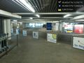
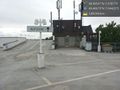
Terminal with Tower. @49.4667,11.0442
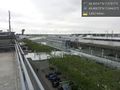
Terminal and view to runway. @49.4667,11.0442
Up and away! @49.4667,11.0442
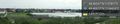
View of Almoshof, Some of the Nürnberg Skyline in the background. @49.4667,11.0442
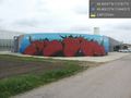
The area near the airport grows some of the best strawberrys I ever tasted. @49.4667,11.0443


Achievements