Difference between revisions of "2008-05-31 39 -77"
From Geohashing
imported>Ciel |
imported>Ciel (unsuccessful attempt, added photos) |
||
| Line 6: | Line 6: | ||
}} | }} | ||
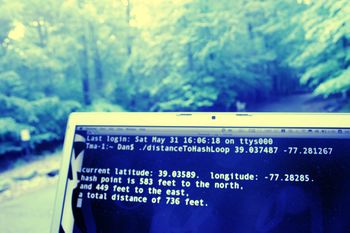
| − | + | [[Image:2008-05-31FrederickUnsuccessful.jpg|thumb|350 px|As close as I could get]] | |
| − | + | [[User:Ciel|Dan]] tried to reach the hash, but couldn't get closer than ~700 feet, since it was on private property. It was a successful test of his gps unit, though! | |
| − | |||
Revision as of 21:11, 31 May 2008
| Sat 31 May 2008 in 39,-77: 39.0374871, -77.2812665 geohashing.info google osm bing/os kml crox |
Dan tried to reach the hash, but couldn't get closer than ~700 feet, since it was on private property. It was a successful test of his gps unit, though!
