Difference between revisions of "2018-04-12 47 -117"
From Geohashing
imported>Thomcat (N. Spokane geohash) |
imported>Thomcat ([live picture]Taking the low bridge [http://www.openstreetmap.org/?lat=47.78262130&lon=-117.40866460&zoom=16&layers=B000FTF @47.7826,-117.4087]) |
||
| Line 28: | Line 28: | ||
--> | --> | ||
<gallery perrow="5"> | <gallery perrow="5"> | ||
| + | |||
| + | Image:2018-04-12_47_-117_thomcat_1523578354595.jpg|Taking the low bridge [http://www.openstreetmap.org/?lat=47.78262130&lon=-117.40866460&zoom=16&layers=B000FTF @47.7826,-117.4087] | ||
</gallery> | </gallery> | ||
Revision as of 00:12, 13 April 2018
| Thu 12 Apr 2018 in Spokane: 47.7896995, -117.4136696 geohashing.info google osm bing/os kml crox |
Location
North Spokane, just north of Fairwood along N. Dartford Road.
Participants
Plans
Meeting downtown at 4, then visit geohash and my dad, who lives in Fairwood.
Expedition
Tracklog
Photos
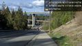
Taking the low bridge @47.7826,-117.4087

Achievements