Difference between revisions of "2008-06-13"
From Geohashing
imported>AshleyMorton |
imported>Tjtrumpet2323 m (moving to proper template) |
||
| Line 2: | Line 2: | ||
{{Expeditions|2008-06-13|datepage}} | {{Expeditions|2008-06-13|datepage}} | ||
{{Template:Expedition Images/2008-06-13}} | {{Template:Expedition Images/2008-06-13}} | ||
| − | |||
| − | |||
Revision as of 15:51, 12 June 2008
Expedition Archives from June 2008
Thursday 12 June 2008 | Friday 13 June 2008 | Saturday 14 June 2008
See also: Category:Meetup on 2008-06-13
Friday 13 June 2008
Coordinates
West of -30°: 0.576378982445, 0.158377823874
East of -30°: 0.321696042405, 0.278954320636
Expeditions
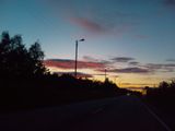
- 2008-06-13 63 10 63.321696°, 10.278954° - Just off the E39, just where it takes off from the E6. Just inside Trondheim kommune. AshleyMorton made it! Clearly a popular fishing hole. Pictures tonight. Arrived at 11:50pm. Good thing it never gets dark here! New Northernmost successful geohash!
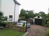
- 2008-06-13 51 -0 51.321696°, -0.278954° - West London Graticule. As it was extremely close to my desk, I popped by today's geohash in Epsom, Surrey and took a few pictures from the closest road. The actual spot is on private property. The photo shows a tree (beyond the lamppost) which I believe to be the geohash location.
- 2008-06-13 42 -71 42.576378N, 71.158378W - Boston graticule. A visit to a World War I memorial in the middle of a traffic island in charming Wilmington, MA.
- 2008-06-13 47 -122 47.57637N, 122.15837W - Seattle graticule. Just off I-90 in South Bellevue, in a driveway.
Photo Gallery
Add your own photo for Friday 13 June


