Difference between revisions of "2008-06-14 37 -77"
imported>Pdkauffmann |
imported>Thomcat (Success/failure category added) |
||
| Line 20: | Line 20: | ||
[[Category:Richmond, VA]] | [[Category:Richmond, VA]] | ||
| + | [[Category:Expeditions]] | ||
| + | [[Category:Expeditions with photos]] | ||
| + | [[Category:Coordinates not reached]] | ||
| + | [[Category:Failed - Did not attempt]] | ||
Revision as of 17:48, 8 August 2008
| Sat 14 Jun 2008 in 37,-77: 37.8067463, -77.0388869 geohashing.info google osm bing/os kml crox |
From the "Upcoming Geohashing Proposals" section of the Richmond Page:
Tyler is wondering why most of the locations are near the edges of the map, far away from people.
Paul wonders the same thing! and has therefore decided that the meeting spot should be in the rocks right off Belle Isle. Go check out the map if you are into that. He will not, however, show up, because he had to work. Sorry folks.
James is going to try and convince Randall to come on Saturday, and shall head for Belle Isle as per Paul's suggestion: 37.53014861,-77.45464325
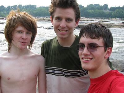
Anyway, Peter read the blag and met up with Randall and Doug on Belle Island downtown since Aylett is a bit too far away. There was a kayak competition going on, and swimming was had by all despite nobody thinking to bring a swimsuit. Alternate meetup site = success. Pictures here
