Difference between revisions of "2020-02-23 59 18"
(Created page with "{{subst:Expedition |lat = 59 |lon = 18 |date = 2020-02-23 }}") |
(new expedition) |
||
| Line 1: | Line 1: | ||
| − | + | {{meetup graticule | |
| − | |||
| − | |||
| − | |||
| − | |||
| − | |||
| − | |||
| − | |||
| − | |||
| lat=59 | | lat=59 | ||
| lon=18 | | lon=18 | ||
| date=2020-02-23 | | date=2020-02-23 | ||
| − | }} | + | }} |
| + | |||
__NOTOC__ | __NOTOC__ | ||
| + | |||
== Location == | == Location == | ||
| − | + | On a highway north of Stockholm. | |
== Participants == | == Participants == | ||
| − | + | [[User:Fractal|Fractal]] ([[User talk:Fractal|talk]]) and Anna | |
| − | |||
| − | |||
| − | |||
| − | |||
== Expedition == | == Expedition == | ||
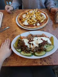
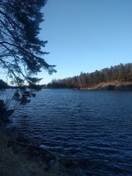
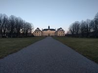
| − | + | We knew that we probably wouldn’t really be able to reach the geohash, as it is located on a highway, but we decided to go for a walk around there anyway. We left from home at about noon, went ice skating for an hour on artificial ice at Östermalms IP, and then kept on walking north for about an hour until we stopped to get some typically Swedish food (for instance a kebab pizza). We then decided to continue by subway, and arrived near the geohash. As expected, the point was situated on the highway, so we could not get closer than 10~20 meters. After that, we were quite close to a very nice area, so we walked for a hour or so in the forest along the northern coast of Bergshamra, until we reached Ulriksdal castle. When we finally decided to go back to the city, a bus appeared out of nowhere so we took it and went to eat some semlor. A very nice day, even though we didn’t actually reach the geohash! | |
| − | |||
| − | |||
| − | |||
| − | == Photos == | + | == Photos == |
| − | <!-- | + | <gallery widths=200px heights=250px> |
| − | Image:2020- | + | Image:2020-02-23_59_18-1.jpg | The kebab pizza! |
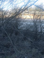
| − | -- | + | Image:2020-02-23_59_18-3.jpg | The geohash is somewhere there |
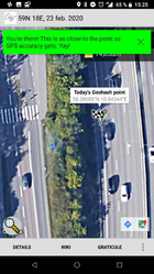
| − | + | Image:2020-02-23_59_18-9.png | This is how close we could get | |
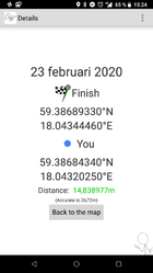
| + | Image:2020-02-23_59_18-8.png | Proof | ||
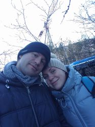
| + | Image:2020-02-23_59_18-2.jpg | Us near the geohash | ||
| + | Image:2020-02-23_59_18-4.jpg | Walking near the water in Bergshamra | ||
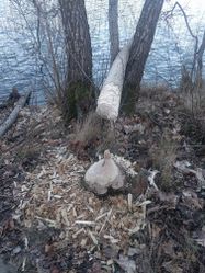
| + | Image:2020-02-23_59_18-5.jpg | Tree cut by a beaver! | ||
| + | Image:2020-02-23_59_18-6.jpg | Ulriksdal castle | ||
| + | Image:2020-02-23_59_18-7.jpg | Semlor! | ||
</gallery> | </gallery> | ||
| − | |||
| − | |||
| − | |||
| − | |||
| − | |||
| − | |||
| − | |||
| − | |||
| − | |||
| − | |||
| − | |||
| − | |||
| − | |||
| − | |||
| − | |||
| − | |||
| − | |||
| − | |||
[[Category:Expeditions]] | [[Category:Expeditions]] | ||
| − | |||
[[Category:Expeditions with photos]] | [[Category:Expeditions with photos]] | ||
| − | |||
| − | |||
| − | |||
| − | |||
| − | |||
| − | |||
| − | |||
| − | |||
[[Category:Coordinates not reached]] | [[Category:Coordinates not reached]] | ||
| − | |||
| − | |||
| − | |||
| − | |||
| − | |||
[[Category:Not reached - No public access]] | [[Category:Not reached - No public access]] | ||
| − | |||
| − | |||
| − | |||
| − | |||
| − | |||
| − | |||
| − | |||
| − | |||
Revision as of 11:58, 30 May 2020
| Sun 23 Feb 2020 in 59,18: 59.3868933, 18.0434446 geohashing.info google osm bing/os kml crox |
Location
On a highway north of Stockholm.
Participants
Expedition
We knew that we probably wouldn’t really be able to reach the geohash, as it is located on a highway, but we decided to go for a walk around there anyway. We left from home at about noon, went ice skating for an hour on artificial ice at Östermalms IP, and then kept on walking north for about an hour until we stopped to get some typically Swedish food (for instance a kebab pizza). We then decided to continue by subway, and arrived near the geohash. As expected, the point was situated on the highway, so we could not get closer than 10~20 meters. After that, we were quite close to a very nice area, so we walked for a hour or so in the forest along the northern coast of Bergshamra, until we reached Ulriksdal castle. When we finally decided to go back to the city, a bus appeared out of nowhere so we took it and went to eat some semlor. A very nice day, even though we didn’t actually reach the geohash!
