Difference between revisions of "2021-07-08 50 7"
From Geohashing
Gefrierbrand (talk | contribs) ([retro picture]nice view [https://openstreetmap.org/?mlat=50.29990530&mlon=7.45932220&zoom=16 @50.2999,7.4593]) |
Gefrierbrand (talk | contribs) (→Photos) |
||
| Line 21: | Line 21: | ||
== Photos == | == Photos == | ||
<gallery perrow="5"> | <gallery perrow="5"> | ||
| − | Image:2021-07- | + | Image:2021-07-08_50_7_Gefrierbrand_1625837746061.jpg|nice road to start |
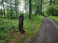
| + | Image:2021-07-08_50_7_Gefrierbrand_1625837711661.jpg|dead end | ||
Image:2021-07-08_50_7_Gefrierbrand_1625837658537.jpg|radio tower | Image:2021-07-08_50_7_Gefrierbrand_1625837658537.jpg|radio tower | ||
Image:2021-07-08_50_7_Gefrierbrand_1625837692149.jpg|bike through there? | Image:2021-07-08_50_7_Gefrierbrand_1625837692149.jpg|bike through there? | ||
| − | Image:2021-07- | + | Image:2021-07-08_50_7_Gefrierbrand_1625839032943.jpg|binoculars guy |
| − | Image:2021-07- | + | Image:2021-07-08_50_7_Gefrierbrand_1625838993695.jpg|difficult terrain |
| − | + | Image:2021-07-08_50_7_Gefrierbrand_1625837207726.jpg|StupidGrin<sup>TM</sup> | |
| − | Image:2021-07- | + | Image:2021-07-08_50_7_Gefrierbrand_1625838938928.jpg|proof |
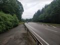
| − | + | Image:2021-07-08_50_7_Gefrierbrand_1625838974397.jpg|A-61 bridge in the background | |
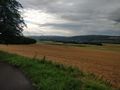
| − | Image:2021-07- | + | Image:2021-07-08_50_7_Gefrierbrand_1625839016703.jpg|castle in the background |
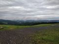
| − | + | Image:2021-07-08_50_7_Gefrierbrand_1625839062336.jpg|nice view despite the clouds | |
| − | Image:2021-07- | ||
| − | |||
| − | Image:2021-07-08_50_7_Gefrierbrand_1625839016703.jpg|castle | ||
| − | |||
| − | |||
| − | |||
| − | Image:2021-07-08_50_7_Gefrierbrand_1625839062336.jpg|nice view | ||
</gallery> | </gallery> | ||
Revision as of 14:00, 9 July 2021
| Thu 8 Jul 2021 in 50,7: 50.2833391, 7.5784299 geohashing.info google osm bing/os kml crox |
Location
In a forest near Waldesch
Participants
Plans
Bike to Waldesch, quickly go to the hash and ride back.
Expedition
Tracklog
Photos
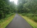
nice road to start
dead end
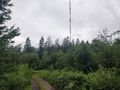
radio tower
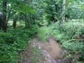
bike through there?
binoculars guy
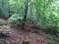
difficult terrain

StupidGrinTM

proof
A-61 bridge in the background
castle in the background
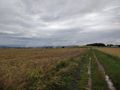
nice view despite the clouds


Achievements
Gefrierbrand earned the Land geohash achievement
|
Gefrierbrand earned the Bicycle geohash achievement
|
Gefrierbrand earned the Drowned Rat Geohash Honourable Mention
|