Difference between revisions of "2008-03-11 48 11"
From Geohashing
(→Photos) |
|||
| Line 17: | Line 17: | ||
<gallery mode="packed" heights="180px"> | <gallery mode="packed" heights="180px"> | ||
File:2008-03-11 48 11 retro path to the hash.jpeg | my path to the hash | File:2008-03-11 48 11 retro path to the hash.jpeg | my path to the hash | ||
| − | |||
File:2008-03-11 48 11 retro me at the hash.jpeg | me at the hash | File:2008-03-11 48 11 retro me at the hash.jpeg | me at the hash | ||
File:2008-03-11 48 11 retro tunnel 2.jpeg | tunnel 2 | File:2008-03-11 48 11 retro tunnel 2.jpeg | tunnel 2 | ||
| Line 23: | Line 22: | ||
File:2008-03-11 48 11 retro proof 1.png | proof 1 | File:2008-03-11 48 11 retro proof 1.png | proof 1 | ||
File:2008-03-11 48 11 retro proof 2.png | proof 2 | File:2008-03-11 48 11 retro proof 2.png | proof 2 | ||
| + | File:2008-03-11 48 11 retro location.jpeg | location | ||
</gallery> | </gallery> | ||
Revision as of 17:26, 22 September 2024
| Tue 11 Mar 2008 in 48,11: 48.2508656, 11.5309572 geohashing.info google osm bing/os kml crox |
Location
On 2024-09-22: In Oberschleißheim in a bushy area next to a pea field
Participants
Expedition
- Iqui on 2024-09-21 : When I arrived there, I thought I'd have to give up and return some time in the winter, because the way to the hash was pretty much completely blocked by bushes. I did find another way to the hash though, by just going around the bushes and walking along the side of the pea field for a bit.
Photos

my path to the hash

me at the hash

tunnel 2

tunnel 1

proof 1

proof 2
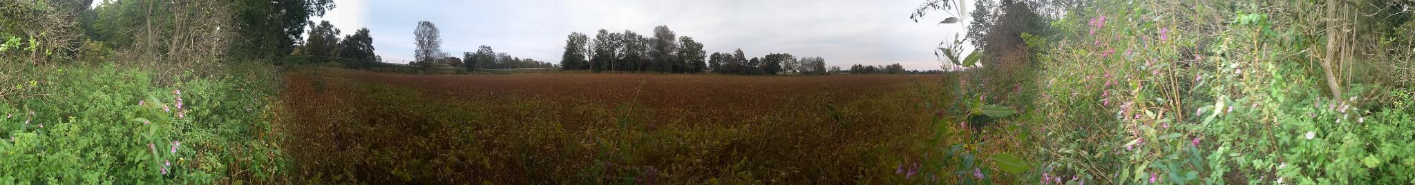
location


