Difference between revisions of "2009-01-09 42 -84"
imported>Excellentdude (2009-01-09 42 -84) |
imported>ReletBot m (Failed => Not reached) |
||
| Line 21: | Line 21: | ||
[[Category:Expeditions with photos]] | [[Category:Expeditions with photos]] | ||
[[Category:Coordinates not reached]] | [[Category:Coordinates not reached]] | ||
| − | [[Category: | + | [[Category:Not reached - No public access]] |
[[Category:Meetup on 2009-01-09]] | [[Category:Meetup on 2009-01-09]] | ||
[[Category:Meetup in 42 -84]] | [[Category:Meetup in 42 -84]] | ||
Revision as of 20:33, 31 March 2009
| Fri 9 Jan 2009 in Lansing: 42.7235006, -84.7687233 geohashing.info google osm bing/os kml crox |
About
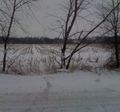
The coordinates were in a field roughly 500 feet off of the nearest road.
Expedition
excellentdude: Once again the coordinates fell just west of the city, very near where they did on 2009-01-05. I was surprised how nicely the roads there were cleaned off then, so I decided to give this one a shot. Well, I keep guessing wrong in both directions about how the roads are going to be. Once I got close, the roads were snow packed. There was enough traffic that I couldn't just stop on the side of the road, and the driveways were almost impossible to see because of the snow. I found the house nearest the hash, but missed the driveway because it was so hard to see. So I went around the country block. Then, I pulled in and asked the woman at the house for permission. She said it wasn't her land and directed me to the next house down the road on the opposite side of the road. Once again, I couldn't see the driveway, missed it, and had to go around. I went up to that house and knocked on the door a couple times. It appeared that no one was home. I didn't feel I should go on the land without that person's permission since the nearest person had already sent me there and would likely see me. So, this expedition is a failure. I've attached a photo of the hash I took from the road. It's in the field, toward the far treeline.
