Difference between revisions of "Brookings, Oregon"
From Geohashing
imported>Michael5000 |
imported>Michael5000 |
||
| Line 13: | Line 13: | ||
}} | }} | ||
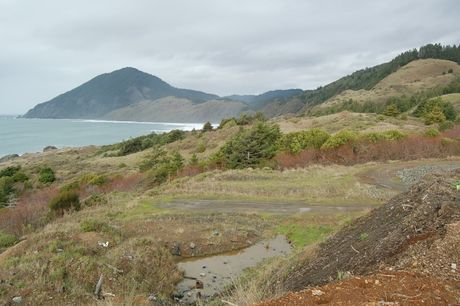
| − | [[Image:20019-12-27 42 -124 03.jpg| | + | [[Image:20019-12-27 42 -124 03.jpg|460px|Humbug Mountain on the Southern Oregon Coast, from near the [[2009-12-27 42 -124|2009-12-27]] hashpoint.]] |
| + | |||
| + | The Brookings, Oregon graticule is located at [[42,-124]]. [http://irc.peeron.com/xkcd/map/map.html?lat=42&long=-124&zoom=9&abs=-1| Today's location.] | ||
| + | |||
| − | |||
== Expedition History == | == Expedition History == | ||
Revision as of 04:07, 1 January 2010
| 43,-125 | Coos Bay | Roseburg |
| 42,-125 | Brookings | Grants Pass |
| 41,-125 | Crescent City, California | Happy Camp, California |
|
Today's location: geohashing.info google osm bing/os kml crox | ||
The Brookings, Oregon graticule is located at 42,-124. Today's location.
Expedition History
2009-12-27
Michael5000 and Mrs.5000 reach a point just off of 101 south of Humbug Mountain
Expedition Success
