Difference between revisions of "2011-07-31 47 7"
From Geohashing
imported>TheOneRing |
imported>TheOneRing |
||
| Line 34: | Line 34: | ||
[[Category:Expeditions with photos]] | [[Category:Expeditions with photos]] | ||
[[Category:Coordinates not reached]] | [[Category:Coordinates not reached]] | ||
| + | [[Category:Not reached - No public access]] | ||
Revision as of 20:48, 4 August 2011
| Sun 31 Jul 2011 in 47,7: 47.0563467, 7.5150552 geohashing.info google osm bing/os kml crox |
Contents
Location
The geohash is located on a field near Jegenstorf, approx. 15km North of Berne.
Participants
TheOneRing - by bike.
The Expedition
TheOneRing
What the heck...? Seriously, what the heck? The second failure in the row.
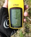
In fact, it was the first day with good weather for weeks, and I decided to go by bike. A little bit up and down, but mostly the roads were flat. After 15km I reached Jegenstorf, drove through and saw crop fields. Unfortunately they were not harvested yet. In the middle of one field there was the geohash...unreachable. I did not came closer than 100m without marching into the field and destroying the grain, and why should I do this? So, I left and felt low.
Well, better try next time.
Photos
TheOneRing
Consolidation prizes
TheOneRing earned the No trespassing consolation prize
|


