Difference between revisions of "2012-03-13 39 -74"
From Geohashing
imported>Mischief (→Tracklog) |
imported>Mischief (→Photos) |
||
| Line 36: | Line 36: | ||
== Photos == | == Photos == | ||
| − | |||
| − | |||
| − | |||
<gallery perrow="5"> | <gallery perrow="5"> | ||
| + | Image:2012_03_13_39_-74_TheHorseIRodeHome.jpg | Witty Comment | ||
</gallery> | </gallery> | ||
Revision as of 13:20, 14 March 2012
| Tue 13 Mar 2012 in 39,-74: 39.9469397, -74.6392158 geohashing.info google osm bing/os kml crox |
Location
The hash itself was in the middle of a cranberry bog ~10m away from the pumping station.
Participants
- Mischief was on this expedition.
- P.K.
- Joe "The Birthday Boy"
Plans
Expedition
Tracklog
So I attempted to log my position using google maps, but I mucked that up. Still we definitely made it. Trust me.
Photos
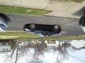
Witty Comment

Achievements