Difference between revisions of "2012-07-30 52 4"
From Geohashing
imported>Murfie (→Plans) |
imported>Murfie (→Photos) |
||
| Line 43: | Line 43: | ||
--> | --> | ||
<gallery perrow="5"> | <gallery perrow="5"> | ||
| + | Image:2012-07-30_52_4_0551.jpg | Building on the other side of the road | ||
| + | Image:2012-07-30_52_4_0552.jpg | My feet at the geohash | ||
| + | Image:2012-07-30_52_4_0554.jpg | The geohash point is right there | ||
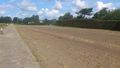
| + | Image:2012-07-30_52_4_0553.jpg | View from the geohash (gardeners) | ||
| + | Image:2012-07-30_52_4_0555.jpg | Sign explaining the purpose of the vegetation | ||
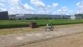
| + | Image:2012-07-30_52_4_0556.jpg | University of Wageningen is doing experiments here | ||
</gallery> | </gallery> | ||
Revision as of 09:51, 5 August 2012
| Mon 30 Jul 2012 in 52,4: 52.2517686, 4.5457375 geohashing.info google osm bing/os kml crox |
Location
Lisse, The Netherlands
Participants
Plans
The plan was to go there somewhere in the morning, because I happened to go there nearby anyway.
Expedition
Tracklog
Photos
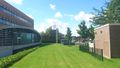
Building on the other side of the road
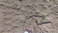
My feet at the geohash
The geohash point is right there
View from the geohash (gardeners)
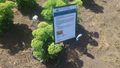
Sign explaining the purpose of the vegetation
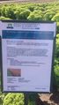
University of Wageningen is doing experiments here


Achievements