Difference between revisions of "2012-08-11 34 -117"
From Geohashing
imported>Mellycopter (→Plans) |
imported>Benglish (→Photos) |
||
| Line 47: | Line 47: | ||
<gallery perrow="5"> | <gallery perrow="5"> | ||
Image:2012-08-11_34_-117_rainDrive.jpg | Rain, Here? | Image:2012-08-11_34_-117_rainDrive.jpg | Rain, Here? | ||
| − | + | Image:2012-08-11_34_-117_madeIt.jpg | We're so accomplished! | |
| + | Image:2012-08-11_34_-117_gmap.jpg | This is what we're looking for. | ||
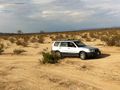
| + | Image:2012-08-11_34_-117_lotsOfDesert.jpg | Yep, exciting place. It looks a lot like the google maps | ||
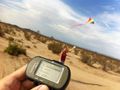
| + | Image:2012-08-11_34_-117_locationProof.jpg | Proof | ||
| + | Image:2012-08-11_34_-117_games.jpg | Saturday /= Game night | ||
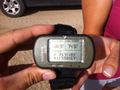
| + | Image:2012-08-11_34_-117_dateProof.jpg | Date Proof | ||
| + | Image:2012-08-11_34_-117_kite.jpg | Flew kite! | ||
| + | Image:2012-08-11_34_-117_maxSpeed.jpg | Maximum Speed! | ||
| + | Image:2012-08-11_34_-117_kiteNcar2.jpg | Maximum Speed with Kite! | ||
| + | Image:2012-08-11_34_-117_kiteNcar.jpg | Maximum Speed with Kite 2 | ||
| + | Image:2012-08-11_34_-117_desert.jpg.jpg | Be still Kite! | ||
| + | Image:2012-08-11_34_-117_rockWhat.jpg | Waz Here | ||
Revision as of 04:09, 17 August 2012
| Sat 11 Aug 2012 in 34,-117: 34.7118274, -117.5016661 geohashing.info google osm bing/os kml crox |
Location
In the middle of the desert, high desert.
Participants
Team MAKE:
Plans
Fly Kites and play boardgames! Too bad no one showed up to play with. :(
Expedition
Tracklog
Photos
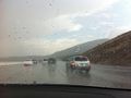
Rain, Here?
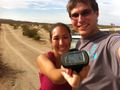
We're so accomplished!
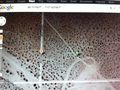
This is what we're looking for.
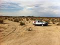
Yep, exciting place. It looks a lot like the google maps
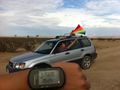
Proof
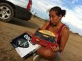
Saturday /= Game night
Date Proof
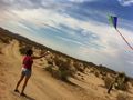
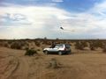
Flew kite!
Maximum Speed!
Maximum Speed with Kite!
Maximum Speed with Kite 2
- 2012-08-11 34 -117 desert.jpg.jpg
Be still Kite!
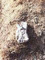
Waz Here


Achievements