Difference between revisions of "2012-10-14 53 -2"
From Geohashing
imported>Angel (That's as close as I can get ... Hash point is occupied by a group of rowdy drunk teenage boys. [http://www.openstreetmap.org/?lat=53.48955693&lon=-2.25667142&zoom=16&layers=B000FTF @53.4896,-2.2567]) |
imported>Angel (→Achievements) |
||
| Line 53: | Line 53: | ||
[[Category:New report]] | [[Category:New report]] | ||
| − | |||
| − | |||
| − | |||
| − | |||
[[Category:Expeditions]] | [[Category:Expeditions]] | ||
| − | |||
| − | |||
| − | |||
| − | |||
| − | |||
| − | |||
| − | |||
| − | |||
| − | |||
| − | |||
[[Category:Coordinates not reached]] | [[Category:Coordinates not reached]] | ||
| − | |||
| − | |||
| − | |||
| − | |||
| − | |||
[[Category:Not reached - No public access]] | [[Category:Not reached - No public access]] | ||
| − | |||
| − | |||
| − | |||
| − | |||
| − | |||
| − | |||
| − | |||
| − | |||
Revision as of 01:42, 21 October 2012
| Sun 14 Oct 2012 in 53,-2: 53.4921706, -2.2631051 geohashing.info google osm bing/os kml crox |
Location
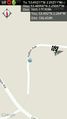
A mile outside Manchester, on the way towards Salford.
Participants
Plans
We're going to a social event in Manchester this afternoon, so it seems convenient to walk up to the hash at some point while I'm in the area.
Expedition
Tracklog
Photos
That's as close as I can get ... Hash point is occupied by a group of rowdy drunk teenage boys. @53.4896,-2.2567
