Difference between revisions of "2012-11-30 29 -82"
From Geohashing
imported>Grumpa (→Plans) |
imported>Grumpa (→Photos) |
||
| Line 42: | Line 42: | ||
--> | --> | ||
<gallery perrow="5"> | <gallery perrow="5"> | ||
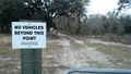
| + | Image:2012-11-30_29_-82-01.jpg | Guess I'm hoofin' it. AND I get to climb a fence. | ||
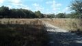
| + | Image:2012-11-30_29_-82-02.jpg | According to the map it should be about half way across this clearing. | ||
| + | Image:2012-11-30_29_-82-03.jpg | A step forward. Two to the left. One step back Everybody now... | ||
| + | Image:2012-11-30_29_-82-04.jpg | Bingo. | ||
| + | Image:2012-11-30_29_-82-05.jpg | Marker. | ||
| + | Image:2012-11-30_29_-82-06.jpg | Marker. | ||
| + | Image:2012-11-30_29_-82-07.jpg | Just off the trail. A good place to hide a marker stake...and a rattlesnake. | ||
| + | Image:2012-11-30_29_-82-08.jpg | The nicest of days. | ||
| + | Image:2012-11-30_29_-82-09.jpg | I've never been out here before even though it is somewhat [http://www.google.com/search?q=Google+watermellon+pond=case notorious]. | ||
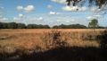
| + | Image:2012-11-30_29_-82-10.jpg | Another beautiful view. | ||
</gallery> | </gallery> | ||
Revision as of 20:00, 30 November 2012
| Fri 30 Nov 2012 in 29,-82: 29.5661283, -82.6142533 geohashing.info google osm bing/os kml crox |
Location
Publically accessible land in the Florida Fish and Wildlife Conservation Commission's Watermelon Pond
Participants
Plans
I should be there around 2:00 pm. The aerial makes it look as if I can drive right on top of it but I'm betting those tracks are FWC vehicles and I'll have to park out on the road.
Expedition
Tracklog
Photos
Guess I'm hoofin' it. AND I get to climb a fence.
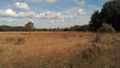
According to the map it should be about half way across this clearing.
A step forward. Two to the left. One step back Everybody now...
Bingo.
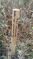
Marker.
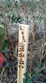
Marker.
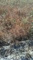
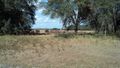
Just off the trail. A good place to hide a marker stake...and a rattlesnake.
The nicest of days.
I've never been out here before even though it is somewhat notorious.
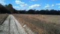
Another beautiful view.


Achievements