Difference between revisions of "2013-08-23 47 0"
From Geohashing
imported>Dunaril ([live picture] Fail [http://www.openstreetmap.org/?lat=47.45940000&lon=.95125900&zoom=16&layers=B000FTF @47.4594,.9513]) |
imported>Dunaril |
||
| Line 45: | Line 45: | ||
TBD | TBD | ||
| − | |||
| − | |||
| − | |||
[[Category:Expeditions]] | [[Category:Expeditions]] | ||
| − | |||
[[Category:Expeditions with photos]] | [[Category:Expeditions with photos]] | ||
| − | |||
| − | |||
| − | |||
| − | |||
| − | |||
| − | |||
| − | |||
| − | |||
| − | |||
[[Category:Coordinates not reached]] | [[Category:Coordinates not reached]] | ||
| − | |||
| − | |||
| − | |||
| − | |||
| − | |||
[[Category:Not reached - No public access]] | [[Category:Not reached - No public access]] | ||
| − | |||
| − | |||
| − | |||
| − | |||
| − | |||
| − | |||
| − | |||
| − | |||
Revision as of 09:28, 24 August 2013
| Fri 23 Aug 2013 in 47,0: 47.4573643, 0.9493154 geohashing.info google osm bing/os kml crox |
Location
Inside a little forest north of Amboise and the Loire river.
Participants
Plans
We are driving from Paris to around Amboise in the evening, and this is the second geohash that's close to our planned course. We'll try to reach it if it's not too late and dark already.
Expedition
TBD
Photos
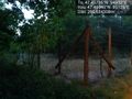
Fail @47.4594,.9513

TBD
Achievements
TBD