Difference between revisions of "2013-10-11 41 -94"
From Geohashing
imported>Trenchcoat (→Photos) |
imported>GeorgDerReisende (gallery repaired + categories) |
||
| Line 1: | Line 1: | ||
| − | |||
| − | |||
| − | |||
| − | |||
| − | |||
| − | |||
| − | |||
| − | |||
| − | |||
| − | |||
{{meetup graticule | {{meetup graticule | ||
| lat=41 | | lat=41 | ||
| Line 18: | Line 8: | ||
__NOTOC__ | __NOTOC__ | ||
== Location == | == Location == | ||
| − | + | ||
In a cornfield east of Brook's Branch, west of Perry, Iowa. | In a cornfield east of Brook's Branch, west of Perry, Iowa. | ||
== Participants == | == Participants == | ||
| − | + | ||
| − | |||
[[User:Trenchcoat|Trenchcoat]] ([[User talk:Trenchcoat|talk]]), | [[User:Trenchcoat|Trenchcoat]] ([[User talk:Trenchcoat|talk]]), | ||
Helen Wells, | Helen Wells, | ||
| Line 30: | Line 19: | ||
== Plans == | == Plans == | ||
| − | + | ||
Drive to the hashpoint from West Des Moines. | Drive to the hashpoint from West Des Moines. | ||
== Expedition == | == Expedition == | ||
| − | + | ||
We([[User:Trenchcoat|Trenchcoat]] ([[User talk:Trenchcoat|talk]]), Helen Wells, Kathryn Wells, and Cassandra Wells) started out from the Waterfront restaurant in West Des Moines, than drove to the fields east of Buck's Branch. [[User:Trenchcoat|Trenchcoat]] ([[User talk:Trenchcoat|talk]]), Kathryn Wells, and Cassandra Wells left the car, walking a short distance. We were unable to reach the hashpoint due to barbed wire fence. | We([[User:Trenchcoat|Trenchcoat]] ([[User talk:Trenchcoat|talk]]), Helen Wells, Kathryn Wells, and Cassandra Wells) started out from the Waterfront restaurant in West Des Moines, than drove to the fields east of Buck's Branch. [[User:Trenchcoat|Trenchcoat]] ([[User talk:Trenchcoat|talk]]), Kathryn Wells, and Cassandra Wells left the car, walking a short distance. We were unable to reach the hashpoint due to barbed wire fence. | ||
| Line 45: | Line 34: | ||
--> | --> | ||
<gallery perrow="5"> | <gallery perrow="5"> | ||
| − | Image: | + | Image:IMG 20131011 184126.jpg | At the Waterfront. |
| − | Image:2013-10-11 | + | Image:Screenshot 2013-10-11-20-58-37.png | Our journey begins. |
| − | Image:2013-10-11 | + | Image:Screenshot 2013-10-11-20-21-47.png | Halfway there. |
| − | Image:2013-10-11 | + | Image:Screenshot 2013-10-11-20-11-24.png | Thwarted here. |
| − | Image: | + | Image:IMG 20131011 205905.jpg | Hard to see, but there's a fence there. |
</gallery> | </gallery> | ||
| Line 57: | Line 46: | ||
| − | + | [[Category:Expeditions]] | |
| − | |||
| − | [[Category: | ||
| − | |||
| − | |||
| − | |||
| − | |||
| − | |||
| − | |||
| − | |||
| − | |||
[[Category:Expeditions with photos]] | [[Category:Expeditions with photos]] | ||
| − | |||
| − | |||
| − | |||
| − | |||
| − | |||
| − | |||
| + | [[Category:Coordinates not reached]] | ||
| − | |||
| − | |||
| − | |||
| − | |||
| − | |||
| − | |||
| − | |||
[[Category:Not reached - No public access]] | [[Category:Not reached - No public access]] | ||
| − | |||
| − | |||
| − | |||
| − | |||
| − | |||
| − | |||
| − | |||
| − | |||
Revision as of 08:42, 17 October 2013
| Fri 11 Oct 2013 in 41,-94: 41.8432419, -94.1671887 geohashing.info google osm bing/os kml crox |
Location
In a cornfield east of Brook's Branch, west of Perry, Iowa.
Participants
Trenchcoat (talk), Helen Wells, Kathryn Wells, Cassandra Wells,
Plans
Drive to the hashpoint from West Des Moines.
Expedition
We(Trenchcoat (talk), Helen Wells, Kathryn Wells, and Cassandra Wells) started out from the Waterfront restaurant in West Des Moines, than drove to the fields east of Buck's Branch. Trenchcoat (talk), Kathryn Wells, and Cassandra Wells left the car, walking a short distance. We were unable to reach the hashpoint due to barbed wire fence.
Tracklog
Photos
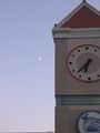
At the Waterfront.
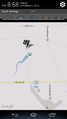
Our journey begins.
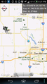
Halfway there.
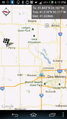
Thwarted here.
Hard to see, but there's a fence there.


