Difference between revisions of "2015-01-15 51 13"
imported>Oisín (→Achievements) |
imported>Danatar (Danatar's report) |
||
| Line 4: | Line 4: | ||
| date=2015-01-15 | | date=2015-01-15 | ||
}} | }} | ||
| − | |||
| − | |||
__NOTOC__ | __NOTOC__ | ||
== Location == | == Location == | ||
| − | + | Today's location is in the [[wikipedia:Allotment (gardening)|allotment garden/community garden]] "Hubertus 1905" in Dresden. | |
| + | |||
| + | Country: Germany; state: Sachsen (Saxony, EU:DE:SN); district: Dresden; Stadtteil: Pieschen-Nord/Trachenberge | ||
| + | |||
== Participants == | == Participants == | ||
| − | [[User:Oisín|Oisín]] | + | *[[User:Oisín|Oisín]] |
| + | *[[User:Danatar|Danatar]] | ||
| − | == Plans == | + | |
| + | ==Oisín== | ||
| + | |||
| + | === Plans === | ||
From the map, the hash is not accessible to the public: it is in an area with small private gardens. But it is less then half a kilometer from my home thus I have to give it a try :-). | From the map, the hash is not accessible to the public: it is in an area with small private gardens. But it is less then half a kilometer from my home thus I have to give it a try :-). | ||
| − | == Expedition == | + | === Expedition === |
After work I cycled first to the market to do some of my shopping and only managed to make it to the hash location shortly after 5 pm. It was already dark (thus sorry for the pictures :-)). I couldn't get closer than about 33m. | After work I cycled first to the market to do some of my shopping and only managed to make it to the hash location shortly after 5 pm. It was already dark (thus sorry for the pictures :-)). I couldn't get closer than about 33m. | ||
I'm a little disappointed to not being able to reach the hash as this would have been one of the rare [[Couch Potato Geohash]] honorable mentions. | I'm a little disappointed to not being able to reach the hash as this would have been one of the rare [[Couch Potato Geohash]] honorable mentions. | ||
| − | == | + | === Photos === |
| − | |||
| − | |||
| − | == | ||
<!-- Insert pictures between the gallery tags using the following format: | <!-- Insert pictures between the gallery tags using the following format: | ||
Image:2012-##-## ## ## Alpha.jpg | Witty Comment | Image:2012-##-## ## ## Alpha.jpg | Witty Comment | ||
--> | --> | ||
<gallery perrow="5"> | <gallery perrow="5"> | ||
| − | |||
| − | |||
Image:2015-01-15_51_13_Oisín_1421337839268.jpg | Closed path [http://www.openstreetmap.org/?lat=51.09186254&lon=13.72649557&zoom=16&layers=B000FTF @51.0919,13.7265] | Image:2015-01-15_51_13_Oisín_1421337839268.jpg | Closed path [http://www.openstreetmap.org/?lat=51.09186254&lon=13.72649557&zoom=16&layers=B000FTF @51.0919,13.7265] | ||
| − | |||
Image:2015-01-15_51_13_Oisín_1421337875964.jpg | View from closest accessible point [http://www.openstreetmap.org/?lat=51.09178328&lon=13.72657721&zoom=16&layers=B000FTF @51.0918,13.7266] | Image:2015-01-15_51_13_Oisín_1421337875964.jpg | View from closest accessible point [http://www.openstreetmap.org/?lat=51.09178328&lon=13.72657721&zoom=16&layers=B000FTF @51.0918,13.7266] | ||
</gallery> | </gallery> | ||
| − | == Achievements == | + | === Achievements === |
{{#vardefine:ribbonwidth|800px}} | {{#vardefine:ribbonwidth|800px}} | ||
| Line 48: | Line 47: | ||
| − | + | ==Danatar== | |
| − | + | As Oisín already mentioned it was clear that this expedition would almost certainly not reach the spot, but I had lots of free time and every Not Trespassing consolation prize gets me nearer to the Posted achievement. Also, ''another'' spot in an allotment garden? The 2014-12-28 spot had already been in one, in the southern part of Dresden, but with lots of snow on that day I didn't even try. | |
| + | |||
| + | I cycled over the Waldschlösschenbrücke, from where I could see the moderate high-water currently occurring. The water was 2-2.3 meters higher than usual (and already 1 meter less than last Monday) and it reached the upper edge of the bank, but at least in Dresden there's almost no land flooded; in comparison, the very bad flooding of 2002 was more than eight meters above normal. I cycled along the Stauffenbergallee, then along some other streets until I was near the hashpoint. The last street was only a dirt track. A few minutes before 3 p.m. I stood before a closed gate. This was a bit surprising because I had expected to be stopped only at the last parcel, 10 meters of the spot. On a day with better weather and thus many people in the allotment this would probably have been the case. I tried the other gates, but all of them were closed, so I started my journey back. On the way, I made some detours to go shopping. | ||
| − | |||
| − | |||
| − | |||
| − | -- | + | {{gallery|width=200|height=200|lines=2 |
| + | |Image:2015-01-15_51_13_hochwasser.jpg|high water | ||
| + | |Image:2015-01-15_51_13_schrebergarten1.jpg|almost there | ||
| + | |Image:2015-01-15_51_13_schrebergarten2.jpg|no trespassing near the spot | ||
| + | |Image:2015-01-15_51_13_schrebergarten3.jpg|no trespassing from the other side | ||
| + | |Image:2015-01-15_51_13_schrebergarten4.jpg|looking into the allotment | ||
| + | }} | ||
| + | |||
| + | |||
| + | ''tracklog will follow'' | ||
| + | [[Category:Expeditions]] | ||
| + | [[Category:Expeditions with photos]] | ||
| + | [[Category:Danatar]] | ||
[[Category:Coordinates not reached]] | [[Category:Coordinates not reached]] | ||
[[Category:Not reached - No public access]] | [[Category:Not reached - No public access]] | ||
Revision as of 20:44, 15 January 2015
| Thu 15 Jan 2015 in 51,13: 51.0921498, 13.7265104 geohashing.info google osm bing/os kml crox |
Location
Today's location is in the allotment garden/community garden "Hubertus 1905" in Dresden.
Country: Germany; state: Sachsen (Saxony, EU:DE:SN); district: Dresden; Stadtteil: Pieschen-Nord/Trachenberge
Participants
Oisín
Plans
From the map, the hash is not accessible to the public: it is in an area with small private gardens. But it is less then half a kilometer from my home thus I have to give it a try :-).
Expedition
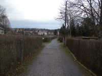
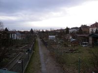
After work I cycled first to the market to do some of my shopping and only managed to make it to the hash location shortly after 5 pm. It was already dark (thus sorry for the pictures :-)). I couldn't get closer than about 33m.
I'm a little disappointed to not being able to reach the hash as this would have been one of the rare Couch Potato Geohash honorable mentions.
Photos
Closed path @51.0919,13.7265
View from closest accessible point @51.0918,13.7266
Achievements
Oisín earned the No trespassing consolation prize
|
Danatar
As Oisín already mentioned it was clear that this expedition would almost certainly not reach the spot, but I had lots of free time and every Not Trespassing consolation prize gets me nearer to the Posted achievement. Also, another spot in an allotment garden? The 2014-12-28 spot had already been in one, in the southern part of Dresden, but with lots of snow on that day I didn't even try.
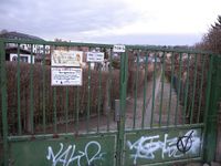
I cycled over the Waldschlösschenbrücke, from where I could see the moderate high-water currently occurring. The water was 2-2.3 meters higher than usual (and already 1 meter less than last Monday) and it reached the upper edge of the bank, but at least in Dresden there's almost no land flooded; in comparison, the very bad flooding of 2002 was more than eight meters above normal. I cycled along the Stauffenbergallee, then along some other streets until I was near the hashpoint. The last street was only a dirt track. A few minutes before 3 p.m. I stood before a closed gate. This was a bit surprising because I had expected to be stopped only at the last parcel, 10 meters of the spot. On a day with better weather and thus many people in the allotment this would probably have been the case. I tried the other gates, but all of them were closed, so I started my journey back. On the way, I made some detours to go shopping.
|
tracklog will follow


