Difference between revisions of "2008-05-24 45 -122"
From Geohashing
imported>Wil (portland graticule cleanup edit) |
imported>Thomcat (category and map added) |
||
| Line 1: | Line 1: | ||
| + | {{meetup graticule | ||
| + | | map=<map lat="45" lon="-122" date="2008-05-24" /> | ||
| + | | lat=45 | ||
| + | | lon=-122 | ||
| + | | date=2008-05-24 | ||
| + | | graticule_name=Portland | ||
| + | | graticule_link=Portland, Oregon | ||
| + | }} | ||
| + | [[Category:Expeditions]] | ||
| + | [[Category:Expeditions with photos]] | ||
| + | |||
| + | ==Expeditions== | ||
= Pictures = | = Pictures = | ||
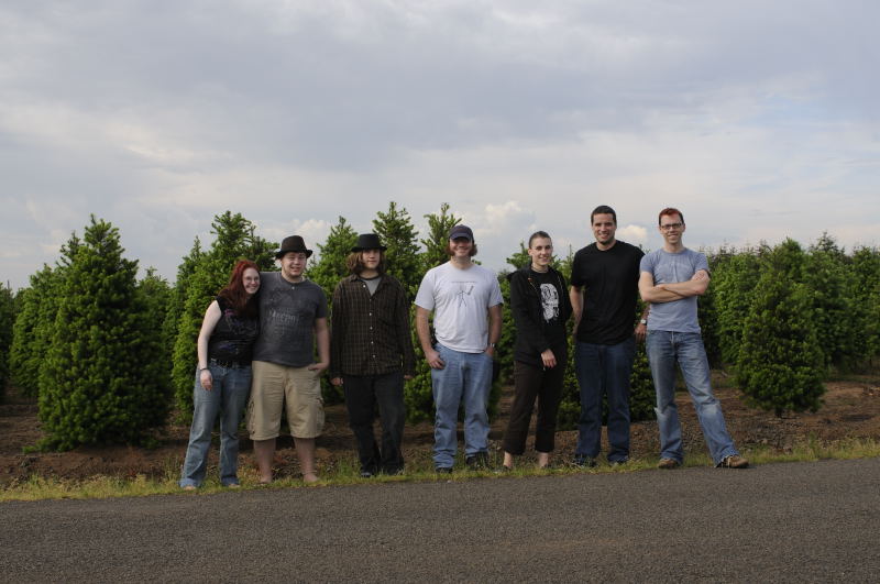
Seven of us made it. | Seven of us made it. | ||
Revision as of 14:19, 31 July 2008
| Sat 24 May 2008 in Portland: 45.1266480, -122.5475331 geohashing.info google osm bing/os kml crox |
Contents
Expeditions
Pictures
Seven of us made it.
Planning and Coordination Archives
5/24/2008 - Saturday
- Wait, don't you have to change the date to 2008-05-24? Then it changes to take place in the Molalla area. I might not make it to Saturday's, but how about Memorial Day's, in Vancouver?
- You're right, I was mistaken about Saturday's location.
- I might be down for Monday's location in Vancouver
- Saturday's location is PERFECT! Who wants to go to a dumb old neighborhood. We get to go tresspassing in some farmer's field! WOO! We'll be there baby!
- I only know of one place to check ownership of Portland-area land, and I don't know how to interpret the lack of ownership information there. -wil
5/23/2008 - Friday
Lake Oswego neighborhood.
Too bad this would have been a better location for Saturday :(
