Difference between revisions of "Oulanka, Finland"
From Geohashing
imported>Tilley |
imported>Tilley |
||
| Line 11: | Line 11: | ||
| s = [[Kuusamo, Finland|Kuusamo]] | | s = [[Kuusamo, Finland|Kuusamo]] | ||
| se = [[Voynitsa, Russia]] | | se = [[Voynitsa, Russia]] | ||
| − | + | }} | |
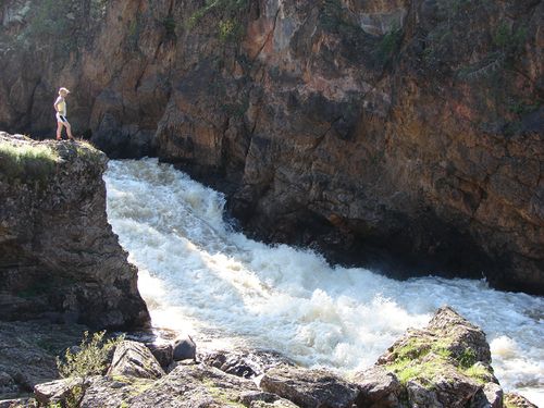
[[File:Oulanka_kiutakongas_1500px.JPG|500px|thumb|left|The Kiutaköngäs waterfall in Oulanka National Park.]] | [[File:Oulanka_kiutakongas_1500px.JPG|500px|thumb|left|The Kiutaköngäs waterfall in Oulanka National Park.]] | ||
Revision as of 11:20, 7 September 2015
| Savukoski | 67,29 | Kovdor, Russia |
| Salla | Oulanka | Alakurtti, Russia |
| Taivalkoski | Kuusamo | Voynitsa, Russia |
|
Today's location: geohashing.info google osm bing/os kml crox | ||
A little over half of this graticule is Russian territory, the rest belongs to Finland. In the Finnish side, there is maybe the finest national park in Finland, [Oulanka National Park]. It's great waterfalls and clear rivers that run through deep canyons cannot be seen in anywhere else in Finland.
Local Geohashers
None.
Meetups
- 1. 2015-09-06_66_29 Reached successfully by Pastori and The Wife
