Difference between revisions of "2017-10-09 47 -122"
From Geohashing
imported>Thomcat ([live picture]Pond [http://www.openstreetmap.org/?lat=47.67746790&lon=-122.25011520&zoom=16&layers=B000FTF @47.6775,-122.2501]) |
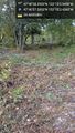
imported>Thomcat ([live picture]Trees [http://www.openstreetmap.org/?lat=47.67710700&lon=-122.25067390&zoom=16&layers=B000FTF @47.6771,-122.2507]) |
||
| Line 49: | Line 49: | ||
Image:2017-10-09_47_-122_thomcat_1507595597961.jpg|Pond [http://www.openstreetmap.org/?lat=47.67746790&lon=-122.25011520&zoom=16&layers=B000FTF @47.6775,-122.2501] | Image:2017-10-09_47_-122_thomcat_1507595597961.jpg|Pond [http://www.openstreetmap.org/?lat=47.67746790&lon=-122.25011520&zoom=16&layers=B000FTF @47.6775,-122.2501] | ||
| + | |||
| + | Image:2017-10-09_47_-122_thomcat_1507595775684.jpg|Trees [http://www.openstreetmap.org/?lat=47.67710700&lon=-122.25067390&zoom=16&layers=B000FTF @47.6771,-122.2507] | ||
</gallery> | </gallery> | ||
Revision as of 00:36, 10 October 2017
| Mon 9 Oct 2017 in 47,-122: 47.6773043, -122.2508183 geohashing.info google osm bing/os kml crox |
Location
Participants
Plans
Expedition
Tracklog
Photos
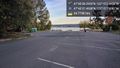
lake wa @47.6771,-122.2508
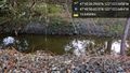
Stream @47.6774,-122.2507

Self @47.6774,-122.2507
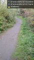
Path @47.6775,-122.2505
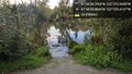
Pond @47.6775,-122.2501
Trees @47.6771,-122.2507


Achievements