Difference between revisions of "2018-02-01 49 8"
imported>DODO |
imported>DODO (→Photos) |
||
| Line 43: | Line 43: | ||
--> | --> | ||
<gallery perrow="5"> | <gallery perrow="5"> | ||
| + | Image:2018-02-01_49_8-1.jpg|the hash is near this muddy road... | ||
| + | Image:2018-02-01_49_8-2.jpg|in this muddy field | ||
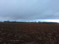
| + | Image:2018-02-01_49_8-3.jpg|view to the west | ||
| + | Image:2018-02-01_49_8-4.jpg|the east | ||
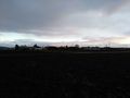
| + | Image:2018-02-01_49_8-5.jpg|and the hasher | ||
| + | unfortnately I lost the screenshot of the proof, but you can check the tracklog. | ||
</gallery> | </gallery> | ||
Revision as of 18:37, 25 February 2018
| Thu 1 Feb 2018 in 49,8: 49.3674101, 8.6210650 geohashing.info google osm bing/os kml crox |
Location
A muddy field between Oftersheim and Heidelberg.
Participants
Plans
Go there by bull on my way home from the office.
Expedition
Well, I made up plans in the office and just started at quarter to 5. After a 12 KM ride along well known streets and bike lanes I had to turn right into a muddy path next to the hash-field. After 200 m I stopped and had just to walk into the fresh ploughed field. The farm was quite near and I didn't want to stay to long. I just took some pictures and a minute after I entered the field I was back at my bull and continued my way home. On the way I bought some meet and reached home 2 minutes to six, just in time to hurry to the beverage shop next door.
Tracklog
Photos
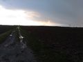
the hash is near this muddy road...
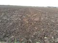
in this muddy field
view to the west
the east

and the hasher
- Unfortnately I lost the screenshot of the proof, but you can check the tracklog.


Achievements