Difference between revisions of "2019-02-14 53 -2"
From Geohashing
imported>Angel ([live picture]Stopped while I was passing. Got to the gates, which is probably about as close as I can get. Best yhe app showed was 180 feet. [http://www.openstreetmap.org/?lat=53.53175930&lon=-2.68326470&zoom=16&layers=B000FTF @53.5318,-2.6833]) |
imported>Angel ([live picture]And a selfie, with the hash 180 feet behind me. [http://www.openstreetmap.org/?lat=53.53395580&lon=-2.67639090&zoom=16&layers=B000FTF @53.5340,-2.6764]) |
||
| Line 41: | Line 41: | ||
Image:2019-02-14_53_-2_Angel_1550154107364.jpg|Stopped while I was passing. Got to the gates, which is probably about as close as I can get. Best yhe app showed was 180 feet. [http://www.openstreetmap.org/?lat=53.53175930&lon=-2.68326470&zoom=16&layers=B000FTF @53.5318,-2.6833] | Image:2019-02-14_53_-2_Angel_1550154107364.jpg|Stopped while I was passing. Got to the gates, which is probably about as close as I can get. Best yhe app showed was 180 feet. [http://www.openstreetmap.org/?lat=53.53175930&lon=-2.68326470&zoom=16&layers=B000FTF @53.5318,-2.6833] | ||
| + | |||
| + | Image:2019-02-14_53_-2_Angel_1550154148889.jpg|And a selfie, with the hash 180 feet behind me. [http://www.openstreetmap.org/?lat=53.53395580&lon=-2.67639090&zoom=16&layers=B000FTF @53.5340,-2.6764] | ||
</gallery> | </gallery> | ||
Revision as of 14:22, 14 February 2019
| Thu 14 Feb 2019 in 53,-2: 53.5325218, -2.6841292 geohashing.info google osm bing/os kml crox |
Location
Participants
Plans
Expedition
Tracklog
Photos
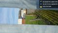
Stopped while I was passing. Got to the gates, which is probably about as close as I can get. Best yhe app showed was 180 feet. @53.5318,-2.6833

And a selfie, with the hash 180 feet behind me. @53.5340,-2.6764


Achievements