Difference between revisions of "2008-06-08 34 -118"
From Geohashing
imported>SouthLAMike |
imported>SouthLAMike m (sp) |
||
| Line 8: | Line 8: | ||
==The Meetup== | ==The Meetup== | ||
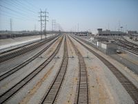
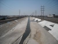
| − | Today's | + | Today's hash was on the tracks of the main rail line through downtown LA by Union Station. The tracks parallel the LA River at that point. |
| − | I [[user:SouthLAMike|Mike]] decided I'd check this hash out on my bike ride. The closest point I managed to reach was on the 1st St Viaduct, and took pictures of the rail line and the river from a location about 50 north of the hash. | + | I, [[user:SouthLAMike|Mike]], decided I'd check this hash out on my bike ride. The closest point I managed to reach was on the 1st St Viaduct, and took pictures of the rail line and the river from a location about 50 north of the hash. |
I'd also hoped to take pictures of it from the east and west sides. The west side of the rail line is all closed off by Metro and Amtrak rail yards. The east side is the river, and there is no easy and legal way to drop into the river at that point. I think I could have done it by hopping a couple of fences, but, I didn't want to leave my bike unattended in Downtown. | I'd also hoped to take pictures of it from the east and west sides. The west side of the rail line is all closed off by Metro and Amtrak rail yards. The east side is the river, and there is no easy and legal way to drop into the river at that point. I think I could have done it by hopping a couple of fences, but, I didn't want to leave my bike unattended in Downtown. | ||
Revision as of 19:57, 8 June 2008
| Sun 8 Jun 2008 in 34,-118: 34.0475817, -118.2309159 geohashing.info google osm bing/os kml crox |
The Meetup
Today's hash was on the tracks of the main rail line through downtown LA by Union Station. The tracks parallel the LA River at that point.
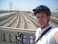
I, Mike, decided I'd check this hash out on my bike ride. The closest point I managed to reach was on the 1st St Viaduct, and took pictures of the rail line and the river from a location about 50 north of the hash.
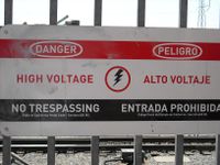
I'd also hoped to take pictures of it from the east and west sides. The west side of the rail line is all closed off by Metro and Amtrak rail yards. The east side is the river, and there is no easy and legal way to drop into the river at that point. I think I could have done it by hopping a couple of fences, but, I didn't want to leave my bike unattended in Downtown.
- Photo Gallery
Bike geohash award!


