Difference between revisions of "2008-06-13"
From Geohashing
imported>Tjtrumpet2323 m |
(→Expeditions) |
||
| Line 8: | Line 8: | ||
=== Expeditions === | === Expeditions === | ||
* [[2008-06-13 63 10]] 63.321696°, 10.278954° - Just off the E39, just where it takes off from the E6. Just inside Trondheim ''kommune''. [[User:AshleyMorton|AshleyMorton]] will try to hit this one, but it will be late in the evening - 9pm or something. Good thing it never gets dark here! | * [[2008-06-13 63 10]] 63.321696°, 10.278954° - Just off the E39, just where it takes off from the E6. Just inside Trondheim ''kommune''. [[User:AshleyMorton|AshleyMorton]] will try to hit this one, but it will be late in the evening - 9pm or something. Good thing it never gets dark here! | ||
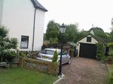
| + | * [[2008-06-13 51 -0]] 51.321696°, -0.278954° - West London Graticule. As it was extremely close to my desk, I popped by today's geohash in Epsom, Surrey and took a few pictures from the closest road. The actual spot is on private property. The photo shows a tree (beyond the lamppost) which I believe to be the geohash location. | ||
=== Photo Gallery === | === Photo Gallery === | ||
{{Expedition Images/2008-06-13}} | {{Expedition Images/2008-06-13}} | ||
Revision as of 22:35, 13 June 2008
Expedition Archives from June 2008
Thursday 12 June 2008 | Friday 13 June 2008 | Saturday 14 June 2008
See also: Category:Meetup on 2008-06-13
Coordinates
West of -30°: 0.576378982445, 0.158377823874
East of -30°: 0.321696042405, 0.278954320636
Expeditions
- 2008-06-13 63 10 63.321696°, 10.278954° - Just off the E39, just where it takes off from the E6. Just inside Trondheim kommune. AshleyMorton will try to hit this one, but it will be late in the evening - 9pm or something. Good thing it never gets dark here!
- 2008-06-13 51 -0 51.321696°, -0.278954° - West London Graticule. As it was extremely close to my desk, I popped by today's geohash in Epsom, Surrey and took a few pictures from the closest road. The actual spot is on private property. The photo shows a tree (beyond the lamppost) which I believe to be the geohash location.


